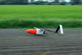
The Convection and Moisture Experiment (CAMEX) studied tropical cyclones and convection to support validation of the Tropical Rainfall Measuring Mission (TRMM) and to improve forecasting and tracking of tropical cyclones. CAMEX had four deployments across the Caribbean, Gulf of Mexico, and Atlantic coast of the United States during the boreal summer and fall of 1993-2001. Airborne and ground-based instruments were used to measure the storm structure and environment of tropical cyclones. CAMEX was funded by NASA through the Mission to Planet Earth.
The CAMEX campaign collaborated with NOAA Hurricane Research Division (HRD) and the TEFLUN campaign on several flights during the third and fourth deployments.
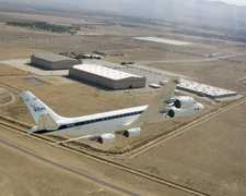
The ER-2 Doppler Radar (EDOP) is an airborne X-band radar designed to operate on the nose of the ER-2 aircraft. It measures radar reflectivity, Doppler velocity, and spectrum width to characterize precipitation systems. EDOP operates at a 9.6 GHz frequency and provides data at a rate of 2 Hz. It has a typical gate spacing of 75 m and a beamwidth of 2.9 degrees. EDOP has been replaced by the EXRAD radar.
The Multispectral Atmospheric Mapping Sounder (MAMS) is an airborne multispectral scanner that was developed by modifying NASA’s Thematic Mapping Sensor (TMS). MAMS measures reflected radiances in eight visible/near-infrared (VNIR) bands and thermal emission in four infrared bands. It was designed to study weather-related phenomena such as storm system structure, cloud-top temperature, and upper atmospheric water vapor. MAMS operates in the 0.42-12.56 μm spectral range across 12 channels. It has a horizontal resolution of 100 m and a swath width of about 37 km at a flight altitude of 20 km. MAMS has a scan rate of 6.25 Hz.
The Lightning Instrument Package (LIP) is an in situ airborne electric field detection system. LIP uses eight electric field mills and a conductivity probe to provide measurements of the three-dimensional components of the electric field of surrounding thunderstorms. LIP has a sampling frequency of 0.02 seconds and has an accuracy of 2.5%.
Earth Science > Atmosphere > Atmospheric Electricity > Electric Field
The Advanced Microwave Precipitation Radiometer (AMPR) is an airborne passive microwave radiometer. AMPR provides calibrated brightness temperature, which can be used to derive cloud and precipitation properties. It operates across four microwave channels: 10.7, 19.35, 37.1, and 85.5 GHz. These frequencies are sensitive to precipitation, thus making AMPR well-suited for rain event studies.
Earth Science > Spectral/engineering > Microwave > Brightness Temperature
This data will be added in future versions
Earth Science > >
The Scanning High-resolution Interferometer Sounder (S-HIS) is an airborne cross-track scanning interferometer developed by the Space Science and Engineering Center at the University of Wisconsin-Madison. It measures the emitted thermal radiation between 3.3 and 18 microns at high spectral resolution. These measurements can be used to derive atmospheric profiles of temperature and water vapor in clear-sky conditions. S-HIS has a spatial resolution of 2 km and a swath width of 40 km at an altitude of 20 km at nadir. It has a sampling frequency of 0.5 s and an absolute radiance accuracy of 0.2 K.
Earth Science > Atmosphere > Atmospheric Water Vapor > Water Vapor Profiles
Earth Science > Atmosphere > Atmospheric Temperature
Earth Science > Atmosphere > Atmospheric Water Vapor
The Millimeter-wave Imaging Radiometer (MIR) was a passive airborne cross-track scanning radiometer developed by NASA. MIR measured brightness temperature across nine channels and was used for clouds, precipitation, and atmospheric water vapor studies. MIR operated near and around the following frequencies: 89, 150, 183, 220, and 325 GHz. It had an angular swath of 100 degrees and a sampling frequency of 3 seconds. MIR typically operated on NASA ER-2 aircraft before its retirement.
Earth Science > Spectral/engineering > Infrared Wavelengths > Brightness Temperature
Earth Science > Atmosphere > Precipitation
Earth Science > Spectral/engineering > Microwave > Brightness Temperature
Earth Science > Atmosphere > Clouds
Earth Science > Atmosphere > Atmospheric Water Vapor
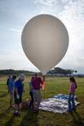
Ozonesondes are in situ balloon-borne instruments used to measure ozone concentration profiles. An ozonesonde consists of an electrochemical ozone sensor connected with a meteorological radiosonde to collect ozone, temperature, pressure, and humidity measurements as it ascends through the atmosphere. It provides ozone profile measurements at a resolution of 100 to 150 m. Ozonesondes have a typical measurement rate of 0.1 Hz and can collect profiles up to around 35 km.
Earth Science > Atmosphere > Atmospheric Water Vapor
Earth Science > Atmosphere > Atmospheric Pressure
Earth Science > Atmosphere > Atmospheric Water Vapor > Water Vapor Profiles
Earth Science > Atmosphere > Atmospheric Temperature > Upper Air Temperature > Vertical Profiles
Earth Science > Atmosphere > Atmospheric Temperature > Upper Air Temperature
Earth Science > Atmosphere > Atmospheric Temperature
Radiosondes are a balloon-borne instrument package used to collect profile measurements of pressure, temperature, humidity, and winds. These sensors are connected to a radio transmitter that sends the measurements to a ground receiver typically operating in the 400-406 MHz range. They typically provide measurements at 1-6 seconds, depending on the type and manufacturer of the radiosonde. Radiosondes are used for weather forecasting, ground truth satellite data, atmospheric research, and input for weather prediction models.
Earth Science > Atmosphere > Atmospheric Water Vapor > Water Vapor Profiles
The Scanning High-resolution Interferometer Sounder (S-HIS) is an airborne cross-track scanning interferometer developed by the Space Science and Engineering Center at the University of Wisconsin-Madison. It measures the emitted thermal radiation between 3.3 and 18 microns at high spectral resolution. These measurements can be used to derive atmospheric profiles of temperature and water vapor in clear-sky conditions. S-HIS has a spatial resolution of 2 km and a swath width of 40 km at an altitude of 20 km at nadir. It has a sampling frequency of 0.5 s and an absolute radiance accuracy of 0.2 K.
Earth Science > Atmosphere > Atmospheric Water Vapor > Water Vapor Profiles
Earth Science > Atmosphere > Atmospheric Temperature
Earth Science > Atmosphere > Atmospheric Water Vapor
This data will be added in future versions
Earth Science > >
The Atmospheric Emitted Radiance Interferometer (AERI) is a ground-based passive interferometer developed by the University of Wisconsin Space Science and Engineering Center (UW-SSEC) for the Department of Energy (DoE) Atmospheric Radiation Measurement (ARM) Program. It uses Fourier transform spectroscopy to measure downwelling thermal infrared emissions from the atmosphere. These measurements can be used to provide profile measurements of atmospheric temperature and water vapor and detect trace gases. AERI operates across the 3.3-19 μm spectral range and up to 25 μm for the extended range version of the instrument. It has an optimal vertical resolution of 100 meters and completes a full sky scan about every 20 seconds.
The ER-2 Doppler Radar (EDOP) is an airborne X-band radar designed to operate on the nose of the ER-2 aircraft. It measures radar reflectivity, Doppler velocity, and spectrum width to characterize precipitation systems. EDOP operates at a 9.6 GHz frequency and provides data at a rate of 2 Hz. It has a typical gate spacing of 75 m and a beamwidth of 2.9 degrees. EDOP has been replaced by the EXRAD radar.
The Multispectral Atmospheric Mapping Sounder (MAMS) is an airborne multispectral scanner that was developed by modifying NASA’s Thematic Mapping Sensor (TMS). MAMS measures reflected radiances in eight visible/near-infrared (VNIR) bands and thermal emission in four infrared bands. It was designed to study weather-related phenomena such as storm system structure, cloud-top temperature, and upper atmospheric water vapor. MAMS operates in the 0.42-12.56 μm spectral range across 12 channels. It has a horizontal resolution of 100 m and a swath width of about 37 km at a flight altitude of 20 km. MAMS has a scan rate of 6.25 Hz.
The Lightning Instrument Package (LIP) is an in situ airborne electric field detection system. LIP uses eight electric field mills and a conductivity probe to provide measurements of the three-dimensional components of the electric field of surrounding thunderstorms. LIP has a sampling frequency of 0.02 seconds and has an accuracy of 2.5%.
Earth Science > Atmosphere > Atmospheric Electricity > Electric Field
The Advanced Microwave Precipitation Radiometer (AMPR) is an airborne passive microwave radiometer. AMPR provides calibrated brightness temperature, which can be used to derive cloud and precipitation properties. It operates across four microwave channels: 10.7, 19.35, 37.1, and 85.5 GHz. These frequencies are sensitive to precipitation, thus making AMPR well-suited for rain event studies.
Earth Science > Spectral/engineering > Microwave > Brightness Temperature
The Scanning High-resolution Interferometer Sounder (S-HIS) is an airborne cross-track scanning interferometer developed by the Space Science and Engineering Center at the University of Wisconsin-Madison. It measures the emitted thermal radiation between 3.3 and 18 microns at high spectral resolution. These measurements can be used to derive atmospheric profiles of temperature and water vapor in clear-sky conditions. S-HIS has a spatial resolution of 2 km and a swath width of 40 km at an altitude of 20 km at nadir. It has a sampling frequency of 0.5 s and an absolute radiance accuracy of 0.2 K.
Earth Science > Atmosphere > Atmospheric Water Vapor > Water Vapor Profiles
Earth Science > Atmosphere > Atmospheric Temperature
Earth Science > Atmosphere > Atmospheric Water Vapor
The Millimeter-wave Imaging Radiometer (MIR) was a passive airborne cross-track scanning radiometer developed by NASA. MIR measured brightness temperature across nine channels and was used for clouds, precipitation, and atmospheric water vapor studies. MIR operated near and around the following frequencies: 89, 150, 183, 220, and 325 GHz. It had an angular swath of 100 degrees and a sampling frequency of 3 seconds. MIR typically operated on NASA ER-2 aircraft before its retirement.
Earth Science > Spectral/engineering > Infrared Wavelengths > Brightness Temperature
Earth Science > Atmosphere > Precipitation
Earth Science > Spectral/engineering > Microwave > Brightness Temperature
Earth Science > Atmosphere > Clouds
Earth Science > Atmosphere > Atmospheric Water Vapor
The Lidar Atmospheric Sensing Experiment (LASE) is an airborne lidar system developed at NASA Langley Research Center (LaRC). LASE uses the differential absorption lidar technique to provide profile measurements of water vapor and aerosols in the atmosphere. LASE operates at the 815 nm wavelength and has a measurement frequency of 5 Hz. For aerosol scattering profiles, LASE has a horizontal resolution of 200m and a vertical resolution of 30m. It has a horizontal resolution of 5 km and a vertical resolution of 0.2 km for water vapor measurements.
Earth Science > Atmosphere > Atmospheric Water Vapor > Water Vapor Profiles
The JPL Laser Hygrometer (JLH) is an in situ airborne hygrometer developed at the Jet Propulsion Laboratory (JPL). It uses a tunable diode laser that operates at 1.37 μm to measure atmospheric water vapor in the upper troposphere and lower stratosphere. JLH has a minimum spatial resolution of 25 m and a detection range of 1 to 500 ppmv. It has a typical sampling rate of 1 Hz and can provide measurements at a precision of 0.05 ppmv.
Earth Science > Atmosphere > Atmospheric Water Vapor > Water Vapor Indicators > Water Vapor
Earth Science > Atmosphere > Atmospheric Water Vapor
The Meteorological Measurement System (MMS) is an in situ airborne instrument used for measuring atmospheric state parameters. MMS provides high-resolution and accurate measurements of atmospheric pressure, temperature, and wind direction/speed immediately around the plane. Additional parameters can be derived such as potential temperature, true airspeed, turbulence dissipation rate, and Reynolds number. Measurements of all parameters are typically collected at a rate of 20 Hz.
The Polarimetric Scanning Radiometer (PSR) is an airborne passive microwave imaging radiometer developed by Georgia Tech and NOAA. It obtains polarimetric microwave emission imagery of Earth to characterize ocean and land surface features, precipitation, ice, and clouds. PSR operates across four microwave channels: 10.7 GHz, 18.7 GHz, 37 GHz, and 89 GHz. The PSR/A version of the sensor has an additional dual-polarimetric channel at 21.5 GHz. At an altitude of 22,000 feet above sea level, PSR has a spatial resolution of 0.3-2.2 km, depending on the frequency band and scan mode.
Earth Science > Spectral/engineering > Microwave > Brightness Temperature
The Airborne Vertical Atmospheric Profiling System (AVAPS) is an airborne system that utilizes dropsondes and Global Positioning System (GPS) receivers to collect in situ profiles of atmospheric state parameters. It provides profile measurements of temperature, pressure, and humidity at a sampling frequency of 0.5 s and measurements of atmospheric winds at a frequency of 0.25 s. AVAPS has a vertical resolution of about 10 m and can allow for dropsonde launches every 20 s. AVAPS was developed by the National Center for Atmospheric Research (NCAR) for the NASA Global Hawk, but it can be deployed on other aircraft such as the DC-8 and P-3.
Earth Science > Atmosphere > Atmospheric Water Vapor > Water Vapor Indicators > Humidity
Earth Science > Atmosphere > Atmospheric Temperature
The Airborne Multichannel Microwave Radiometer (AMMR) was a remote passive, airborne microwave radiometer. It measured thermal microwave emissions in terms of brightness temperature. AMMR consisted of an array of radiometers that operated at the following frequencies: 10, 18.7, 21, 37, and 92 GHz. It had a typical sampling rate of 1 second and a spatial resolution of 1-2 km at the surface.
Earth Science > Spectral/engineering > Microwave > Brightness Temperature
The Airborne Rain Mapping Radar (ARMAR) is an airborne Ku-band Doppler radar developed by the Jet Propulsion Laboratory (JPL). It was developed to simulate Tropical Rainfall Measuring Mission (TRMM) satellite mission for algorithm development and calibration. ARMAR operates at the 13.8 GHz frequency to measure the return power of microwave energy to calculate the velocity and reflectivity. It also can be operated as a radiometer to measure brightness temperature. ARMAR typically scan across track at 20 degrees angles, but also has the ability to operate at a fixed angle. ARMAR has a horizontal resolution of 800m and a swath width of 9km at flight altitude of 12km.
The JPL Surface Acoustic Wave (SAW) Hygrometer is an in situ airborne microhygrometer developed by the Jet Propulsion Laboratory (JPL). It uses a SAW device to detect condensation for dewpoint or frostpoint temperature measurements. The JPL SAW hygrometer is two orders of magnitude more sensitive to condensation compared to chilled-mirror hygrometers, allowing for a faster response to humidity changes. JPL SAW Hygrometer has a temporal resolution of up to 0.1 seconds.
Earth Science > Atmosphere > Atmospheric Water Vapor
Earth Science > Atmosphere > Atmospheric Temperature > Upper Air Temperature > Dew Point Temperature
Earth Science > Atmosphere > Atmospheric Water Vapor > Water Vapor Indicators > Water Vapor
Earth Science > Atmosphere > Atmospheric Water Vapor > Water Vapor Indicators > Humidity
Earth Science > Atmosphere > Atmospheric Water Vapor > Water Vapor Indicators > Dew Point Temperature
The Forward Scattering Spectrometer Probe (FSSP) is an in situ airborne optical particle counter originally designed by Particle Measuring Systems, Inc. It provides particle size distribution by measuring the intensity of the light scattered by individual particles within the cloud. FSSP can detect particles within a diameter range of 0.5 to 47 μm. It operates at a wavelength of 633 nm and has a typical sampling frequency of 1 Hz.
The 2D-C/P Hydrometeor Imaging Probe (2D-C/P) is an in situ, airborne instrument that captures imagery of hydrometeors. It collects these images by recording the status (illuminated or shadowed) of the photodiode array as the shadow of the hydrometeors passes over. 2D-C/P also provides measurements of particle size distribution, cloud droplet concentration, and hydrometeor shape. Typically, 2D-C/P probes have an image resolution of 25 micrometers and can image hydrometeors with diameters up to 1600 micrometers.
Radiosondes are a balloon-borne instrument package used to collect profile measurements of pressure, temperature, humidity, and winds. These sensors are connected to a radio transmitter that sends the measurements to a ground receiver typically operating in the 400-406 MHz range. They typically provide measurements at 1-6 seconds, depending on the type and manufacturer of the radiosonde. Radiosondes are used for weather forecasting, ground truth satellite data, atmospheric research, and input for weather prediction models.
Earth Science > Atmosphere > Atmospheric Water Vapor > Water Vapor Profiles
The ER-2 Doppler Radar (EDOP) is an airborne X-band radar designed to operate on the nose of the ER-2 aircraft. It measures radar reflectivity, Doppler velocity, and spectrum width to characterize precipitation systems. EDOP operates at a 9.6 GHz frequency and provides data at a rate of 2 Hz. It has a typical gate spacing of 75 m and a beamwidth of 2.9 degrees. EDOP has been replaced by the EXRAD radar.
The NPOESS Aircraft Sounder Testbed - Microwave (NAST-M) is an airborne microwave radiometer maintained by the Massachusetts Institute of Technology (MIT). It measures brightness temperature which can be used to retrieve water vapor profiles in the atmosphere. It consists of two radiometers with one operating across 8 channels between 50-57 GHz and the other operating across 9 channels at 118 GHz. In 2003, NAST-M was upgraded with two additional radiometers operating at 183 and 425 GHz to improve water vapor retrievals and the detection of small hydrometeors. NAST-M has a spatial resolution of 2.6 km and a cross-track swath width of 100 km at a flight altitude of 20 km. It has a typical integration time of 100 ms.
Earth Science > Atmosphere > Atmospheric Water Vapor > Water Vapor Indicators > Water Vapor
Earth Science > Atmosphere > Atmospheric Water Vapor > Water Vapor Profiles
Earth Science > Spectral/engineering > Microwave > Brightness Temperature
Earth Science > Atmosphere > Atmospheric Water Vapor
Earth Science > Atmosphere > Atmospheric Temperature
The Multispectral Atmospheric Mapping Sounder (MAMS) is an airborne multispectral scanner that was developed by modifying NASA’s Thematic Mapping Sensor (TMS). MAMS measures reflected radiances in eight visible/near-infrared (VNIR) bands and thermal emission in four infrared bands. It was designed to study weather-related phenomena such as storm system structure, cloud-top temperature, and upper atmospheric water vapor. MAMS operates in the 0.42-12.56 μm spectral range across 12 channels. It has a horizontal resolution of 100 m and a swath width of about 37 km at a flight altitude of 20 km. MAMS has a scan rate of 6.25 Hz.
The Lightning Instrument Package (LIP) is an in situ airborne electric field detection system. LIP uses eight electric field mills and a conductivity probe to provide measurements of the three-dimensional components of the electric field of surrounding thunderstorms. LIP has a sampling frequency of 0.02 seconds and has an accuracy of 2.5%.
Earth Science > Atmosphere > Atmospheric Electricity > Electric Field
The NPOESS Aircraft Sounder Testbed - Interferometer (NAST-I) is an airborne infrared interferometer maintained and operated by NASA Langley Research Center (LaRC). It uses Fourier transform spectroscopy to provide measurements of brightness temperature and radiance. NAST-I operates within the spectral range of 3.7-16.1 µm and has a spectral resolution of 0.25 cm-1. It has a spatial resolution of 2.6 km and a cross-track swath width of 46 km at a flight altitude of 20 km. A complete scan period for NAST-I takes around 12.2 seconds.
Earth Science > Atmosphere > Atmospheric Temperature > Atmospheric Temperature Indices
Earth Science > Atmosphere > Atmospheric Temperature
The Advanced Microwave Precipitation Radiometer (AMPR) is an airborne passive microwave radiometer. AMPR provides calibrated brightness temperature, which can be used to derive cloud and precipitation properties. It operates across four microwave channels: 10.7, 19.35, 37.1, and 85.5 GHz. These frequencies are sensitive to precipitation, thus making AMPR well-suited for rain event studies.
Earth Science > Spectral/engineering > Microwave > Brightness Temperature
The MODIS Airborne Simulator (MAS) is an airborne multispectral spectrometer designed to simulate the satellite instrument Moderate-Resolution Imaging Spectrometer (MODIS). MAS operates across 50 spectral channels in the 0.55 to 14.2 μm range to provide high-resolution imagery of clouds and surface features. MAS has a horizontal spatial resolution of 50 m and a swath width of about 36 km at an altitude of 20 km at nadir. It has a scan rate of 6.25 Hz with each scan line containing 716 pixels.
The Millimeter-wave Imaging Radiometer (MIR) was a passive airborne cross-track scanning radiometer developed by NASA. MIR measured brightness temperature across nine channels and was used for clouds, precipitation, and atmospheric water vapor studies. MIR operated near and around the following frequencies: 89, 150, 183, 220, and 325 GHz. It had an angular swath of 100 degrees and a sampling frequency of 3 seconds. MIR typically operated on NASA ER-2 aircraft before its retirement.
Earth Science > Spectral/engineering > Infrared Wavelengths > Brightness Temperature
Earth Science > Atmosphere > Precipitation
Earth Science > Spectral/engineering > Microwave > Brightness Temperature
Earth Science > Atmosphere > Clouds
Earth Science > Atmosphere > Atmospheric Water Vapor
The Atmospheric Emitted Radiance Interferometer (AERI) is a ground-based passive interferometer developed by the University of Wisconsin Space Science and Engineering Center (UW-SSEC) for the Department of Energy (DoE) Atmospheric Radiation Measurement (ARM) Program. It uses Fourier transform spectroscopy to measure downwelling thermal infrared emissions from the atmosphere. These measurements can be used to provide profile measurements of atmospheric temperature and water vapor and detect trace gases. AERI operates across the 3.3-19 μm spectral range and up to 25 μm for the extended range version of the instrument. It has an optimal vertical resolution of 100 meters and completes a full sky scan about every 20 seconds.
The ER-2 Doppler Radar (EDOP) is an airborne X-band radar designed to operate on the nose of the ER-2 aircraft. It measures radar reflectivity, Doppler velocity, and spectrum width to characterize precipitation systems. EDOP operates at a 9.6 GHz frequency and provides data at a rate of 2 Hz. It has a typical gate spacing of 75 m and a beamwidth of 2.9 degrees. EDOP has been replaced by the EXRAD radar.
The High Altitude Monolithic Microwave integrated Circuit (MMIC) Sounding Radiometer (HAMSR) is an airborne microwave sounder developed by the Jet Propulsion Laboratory under the NASA Instrument Incubator Program. HAMSR measures brightness temperature which can be used to derive three-dimensional profiles of temperature, water vapor, and cloud liquid water in the atmosphere. It operates across 25 spectral channels in 3 microwave bands (50-60 GHz, 118 GHz, 183 GHz) and has a sampling frequency of 5 seconds. HAMSR has a horizontal spatial resolution of 2 km at nadir and a field of view of about 40 km at an altitude of 20 km.
Earth Science > Atmosphere > Atmospheric Temperature
Earth Science > Atmosphere > Atmospheric Water Vapor > Water Vapor Indicators > Humidity > Absolute Humidity
Earth Science > Atmosphere > Atmospheric Water Vapor
Earth Science > Atmosphere > Atmospheric Water Vapor > Water Vapor Indicators > Water Vapor
Earth Science > Atmosphere > Atmospheric Water Vapor > Water Vapor Indicators > Humidity > Relative Humidity
Earth Science > Spectral/engineering > Microwave > Brightness Temperature
Earth Science > Atmosphere > Atmospheric Temperature > Upper Air Temperature
Earth Science > Atmosphere > Atmospheric Water Vapor > Water Vapor Indicators > Total Precipitable Water
The MODIS Airborne Simulator (MAS) is an airborne multispectral spectrometer designed to simulate the satellite instrument Moderate-Resolution Imaging Spectrometer (MODIS). MAS operates across 50 spectral channels in the 0.55 to 14.2 μm range to provide high-resolution imagery of clouds and surface features. MAS has a horizontal spatial resolution of 50 m and a swath width of about 36 km at an altitude of 20 km at nadir. It has a scan rate of 6.25 Hz with each scan line containing 716 pixels.
A dropsondes or dropwindsondes are in situ instruments designed to be released from aircraft. They are equipped with Global Positioning System (GPS) receivers and sensors to collect profile measurements of pressure, temperature, humidity, wind speed, and direction. Dropsondes are important during field investigations because they allow researchers to collect vertical profiles in remote locations and during severe weather events. Dropsondes typically have a vertical resolution of 5 m and provide measurements of wind speed/direction every 0.25 seconds and temperature, pressure, and humidity every 0.5 seconds.
Earth Science > Atmosphere > Atmospheric Temperature
The Lyman-alpha Hygrometer is an in situ hygrometer that can be deployed on airborne or ground-based platforms. It measures water vapor absorption at the Lyman-alpha wavelength (121.6 nm) of atomic hydrogen to determine the total water in the atmosphere. It has a detection limit of 0.1 ppmv and a typical data rate of 1 second. The Lyman-alpha hygrometer provides water vapor measurements with an accuracy of 6% and a precision of 5%.
Earth Science > Atmosphere > Atmospheric Water Vapor > Water Vapor Indicators > Water Vapor
Earth Science > Atmosphere > Atmospheric Water Vapor > Water Vapor Profiles > Water Vapor Mixing Ratio Profiles
Earth Science > Atmosphere > Atmospheric Water Vapor > Water Vapor Indicators > Total Precipitable Water
Earth Science > Atmosphere > Atmospheric Water Vapor
The Lightning Instrument Package (LIP) is an in situ airborne electric field detection system. LIP uses eight electric field mills and a conductivity probe to provide measurements of the three-dimensional components of the electric field of surrounding thunderstorms. LIP has a sampling frequency of 0.02 seconds and has an accuracy of 2.5%.
Earth Science > Atmosphere > Atmospheric Electricity > Electric Field
The Microwave Temperature Profiler (MTP) is an airborne microwave radiometer developed by the Jet Propulsion Laboratory and later modified by NCAR. It measures thermal emissions from oxygen molecules in the atmosphere to prove temperature profiles above, below, and at flight level. It operates between 55 to 59 GHz and provides profiles every 17 seconds with 4 km horizontal spacing. MTP has a vertical resolution of 150 m near the aircraft.
Earth Science > Spectral/engineering > Microwave > Brightness Temperature
The Advanced Microwave Precipitation Radiometer (AMPR) is an airborne passive microwave radiometer. AMPR provides calibrated brightness temperature, which can be used to derive cloud and precipitation properties. It operates across four microwave channels: 10.7, 19.35, 37.1, and 85.5 GHz. These frequencies are sensitive to precipitation, thus making AMPR well-suited for rain event studies.
Earth Science > Spectral/engineering > Microwave > Brightness Temperature
The NOAA Dual-Beam UV-Absorption Ozone Photometer (NOAA-O3) is an in situ optical balloon-borne and airborne instrument that measures ozone concentrations in the troposphere and lower stratosphere. It operates at the 254 nm wavelength allowing it to calculate the ozone number density due to the accurate ozone absorption cross section at that wavelength. It has a sampling rate of 2 Hz and a horizontal resolution of 100 to 200 meters at typical research flight speeds.
Earth Science > Atmosphere > Air Quality > Tropospheric Ozone
Ceilometers are ground-based, remote-sensing sensors that provide measurements of cloud ceilings and vertical visibility. They use either a laser beam or another light source to detect backscatter of clouds, precipitation, and aerosols. Ceilometers can provide detailed and accurate measurements in all types of weather conditions and have low operating costs. Ceilometers are typically used in boundary layer and cloud research applications.
The Ultra-High Frequency (UHF) Wind Profiler is a ground-based Doppler radar. It measures electromagnetic signals to detect wind speed and direction. UHF Wind Profilers operate at the 300-1000 MHz frequency range. Due to operating at a high frequency, they allow for high-resolution wind measurements within the boundary layer.
The Shared Mobile Atmospheric Research and Teaching Radar (SMART-R) is a mobile Doppler radar platform program operated by the University of Oklahoma. SMART-R is a C-band radar that is mounted on a truck to collect radar measurements during precipitation events such as tornadic storms, hurricanes, and flash floods. SMART-R has a beamwidth of 1.5 degrees and a selectable bin spacing of 67 to 2000 meters. The University of Oklahoma operates two SMART-R C-band radars: SR-1 (5635 MHz) and SR-2 (5612.82 MHz).
The Microwave Profiling Radiometer (MPR) is a ground-based passive radiometer manufactured by Radiometrics Corporation. It measures brightness temperature across 21 K-band frequency (21-30 GHz) channels and 14 V-band frequency (51-59 GHz) channels. These measurements can be used to retrieve cloud base temperature, cloud base height, integrated liquid, and profiles of temperature, water vapor, relative humidity, and liquid water. MPR has a vertical range from the surface to 10 km and provides retrievals every 1 minute. It has a height resolution of 50 m from the surface to 0.5 km, 100 m from 0.5 to 2 km, and 250 m from 2 to 10 km.
Earth Science > Spectral/engineering > Microwave > Brightness Temperature
This data will be added in future versions
Earth Science > >
An Electric Field Mill (EFM) is an in situ airborne and ground-based electric sensor designed and built at NASA Marshall Space Flight Center (MSFC). It measures the full vector components of the atmospheric electric field and provides details about the electrical structure within and around a storm. EFMs can detect both intracloud and cloud-to-ground lightning and can operate during large thunderstorm fields (thousands of volts/meter). An EFM has a typical time response of about 10 Hz.
Earth Science > Atmosphere > Atmospheric Electricity > Electric Field
Generic-Atmospheric State (Gen-AtmsState) refers to non-specific instruments on a platform used for measurements of atmospheric state parameters. These are typically in situ sensors that measure temperature, pressure, humidity, and wind speed/direction. Types of atmospheric state instruments include thermometers, hygrometers, barometers, and anemometers.
Earth Science > Atmosphere > Atmospheric Water Vapor
Earth Science > Atmosphere > Atmospheric Pressure
Earth Science > Atmosphere > Atmospheric Water Vapor > Water Vapor Indicators > Humidity
Earth Science > Atmosphere > Atmospheric Temperature > Surface Temperature > Air Temperature
The Lower Fuselage (LF) Radar is an airborne radar system that operates on the lower fuselage of the NOAA P-3 aircraft used by the Hurricane Research Division. It measures radar reflectivity, Doppler velocity, and other radar parameters to characterize tropical storms and precipitation. It operates at the 5370 MHz frequency and has a horizontal beamwidth of 1.1 degrees. The LF Radar has a maximum ambiguous range of 750 km and a pulse repetition frequency of 200 Hz.
An Electric Field Mill (EFM) is an in situ airborne and ground-based electric sensor designed and built at NASA Marshall Space Flight Center (MSFC). It measures the full vector components of the atmospheric electric field and provides details about the electrical structure within and around a storm. EFMs can detect both intracloud and cloud-to-ground lightning and can operate during large thunderstorm fields (thousands of volts/meter). An EFM has a typical time response of about 10 Hz.
Earth Science > Atmosphere > Atmospheric Electricity > Electric Field
The King Probe is an airborne cloud probe developed by Warren King (Commonwealth Scientific and Industrial Research Organisation) and manufactured by Particle Measuring Systems (PMS) and Droplet Measurement Technologies (DMT). The King Probe provides measurements of cloud liquid water content (LWC) by measuring the heat released when water droplets are vaporized. The King Probe operates at a constant temperature (~100 C) and has a data output rate of 1 to 10 Hz. It is typically used in cloud microphysics and aircraft icing studies.
The Rosemount Icing Detector (RICE) is an in situ airborne probe manufactured by Rosemount Inc. It is a magnetostrictive oscillation probe that detects changes in the frequency of oscillation due to ice buildup on the sensing cylinder. These changes in frequency can be related to the rate of ice accretion, which can be used to derive liquid water content. RICE has a typical sampling rate of 1 second.
The Tail Doppler Radar (TDR) is an airborne vertically scanning, pulse Dopper X-band radar operated by NOAA. It is installed on the tail of the research aircraft and is typically equipped on NOAA’s P-3 aircraft for hurricane and precipitation research missions. TDR measures radar reflectivity and Doppler wind velocities at the 9315 MHz frequency band. It has a horizontal beam width of 1.35 degrees and a range gate spacing of 150 or 300 meters.
The Forward Scattering Spectrometer Probe (FSSP) is an in situ airborne optical particle counter originally designed by Particle Measuring Systems, Inc. It provides particle size distribution by measuring the intensity of the light scattered by individual particles within the cloud. FSSP can detect particles within a diameter range of 0.5 to 47 μm. It operates at a wavelength of 633 nm and has a typical sampling frequency of 1 Hz.
The 2D-C/P Hydrometeor Imaging Probe (2D-C/P) is an in situ, airborne instrument that captures imagery of hydrometeors. It collects these images by recording the status (illuminated or shadowed) of the photodiode array as the shadow of the hydrometeors passes over. 2D-C/P also provides measurements of particle size distribution, cloud droplet concentration, and hydrometeor shape. Typically, 2D-C/P probes have an image resolution of 25 micrometers and can image hydrometeors with diameters up to 1600 micrometers.
Generic-Atmospheric State (Gen-AtmsState) refers to non-specific instruments on a platform used for measurements of atmospheric state parameters. These are typically in situ sensors that measure temperature, pressure, humidity, and wind speed/direction. Types of atmospheric state instruments include thermometers, hygrometers, barometers, and anemometers.
Earth Science > Atmosphere > Atmospheric Water Vapor
Earth Science > Atmosphere > Atmospheric Pressure
Earth Science > Atmosphere > Atmospheric Water Vapor > Water Vapor Indicators > Humidity
Earth Science > Atmosphere > Atmospheric Temperature > Surface Temperature > Air Temperature
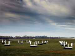
Rain gauges are ground-based instruments that provide in situ measurements of liquid precipitation amounts over a set time. There are multiple types of rain gauges that each collect and record data differently such as the tipping bucket rain gauge and weighing precipitation gauge. Rain gauges can be deployed in various locations due to their relatively small size and easy set-up and are typically colocated with other precipitation instruments such as disdrometers to provide more details about precipitation being collected such as precipitation rate and size distribution.
The X-Band Polarimetric Doppler Weather Radar (XPOL) is a ground-based, transportable polarimetric radar manufactured by ProSensing. XPOL measures reflectivity, Doppler velocity, and polarimetric radar parameters to characterize precipitation and clouds. XPOL operates at a 9.41 GHz frequency and has a typical beam width of 1.4 degrees. It has a selectable range resolution of 15-150 meters.
The Tropical Ocean/Global Atmosphere (TOGA) C-band Radar is a ground-based radar that was developed for the TOGA COARE campaign. It is a C-band (5600-5650 MHz) Doppler radar that measures reflectivity, Doppler velocity, spectrum width, and other radar parameters to characterize precipitation. It is currently located at Wallops Flight Facility (WFF) and can be deployed for land or sea-based operations. The TOGA radar has a beam width of 1.55 degrees and a typical bin spacing of 150 meters.
The NASA S-band Dual Polarimetric Radar (NPOL) is a transportable, ground-based scanning dual polarimetric Doppler radar. As an active remote sensor, NPOL detects returned electromagnetic radiation to identify radar reflectivity, Doppler velocity, rainfall rate, particle size distribution, water contents, and precipitation type. Under typical operating conditions, NPOL has a beamwidth of 0.95° and a 150 km maximum range. NPOL is operationally equivalent to Doppler radars employed by the U.S. National Weather Service’s Next Generation Weather Radar (NEXRAD) network, but NPOL has the added advantage of being fully deployable.
The Microwave Temperature Profiler (MTP) is an airborne microwave radiometer developed by the Jet Propulsion Laboratory and later modified by NCAR. It measures thermal emissions from oxygen molecules in the atmosphere to prove temperature profiles above, below, and at flight level. It operates between 55 to 59 GHz and provides profiles every 17 seconds with 4 km horizontal spacing. MTP has a vertical resolution of 150 m near the aircraft.
Earth Science > Spectral/engineering > Microwave > Brightness Temperature
This data will be added in future versions
Earth Science > >
The Cloud Particle Imager (CPI) is an airborne imager manufactured by SPEC Inc. CPI collects high-resolution (2.3 μm pixel size) images of cloud particles that pass through its sample volume. It uses a charge-coupled device (CCD) camera that operates at 810 nm to record images and can take up to 74 frames per second with a refresh rate of 40 Hz. The imagery from CPI can be used to derive microphysical properties such as particle size and habit.
The Counterflow Virtual Impactor (CVI) is an in situ airborne instrument that samples cloud droplets. It samples cloud droplets by removing them from the surrounding air through inertial impaction. CVI is typically deployed with additional sensors to provide measurements of cloud particle concentration, cloud liquid water, and water vapor of the sample droplets. CVI can detect cloud droplets as small as 7 microns in diameter and has a typical time response of 1 second.
The Lightning Instrument Package (LIP) is an in situ airborne electric field detection system. LIP uses eight electric field mills and a conductivity probe to provide measurements of the three-dimensional components of the electric field of surrounding thunderstorms. LIP has a sampling frequency of 0.02 seconds and has an accuracy of 2.5%.
Earth Science > Atmosphere > Atmospheric Electricity > Electric Field
The Nezorov Probe is an in situ airborne hot-wire probe that measures the liquid water content (LWC) and total water content (TWC) of clouds. It determines LWC and WC by detecting heat loss of its two sensors by evaporation of cloud water and by convective heat losses. At a constant temperature of 90 degrees Celsius, it can measure LWC and TWC in the range of 0.005-3 grams per cubic meter. The Nevzorov Probe provides measurements at 1-second intervals with an accuracy of 10%.
The Lyman-alpha Hygrometer is an in situ hygrometer that can be deployed on airborne or ground-based platforms. It measures water vapor absorption at the Lyman-alpha wavelength (121.6 nm) of atomic hydrogen to determine the total water in the atmosphere. It has a detection limit of 0.1 ppmv and a typical data rate of 1 second. The Lyman-alpha hygrometer provides water vapor measurements with an accuracy of 6% and a precision of 5%.
Earth Science > Atmosphere > Atmospheric Water Vapor > Water Vapor Indicators > Water Vapor
Earth Science > Atmosphere > Atmospheric Water Vapor > Water Vapor Profiles > Water Vapor Mixing Ratio Profiles
Earth Science > Atmosphere > Atmospheric Water Vapor > Water Vapor Indicators > Total Precipitable Water
Earth Science > Atmosphere > Atmospheric Water Vapor
The High Volume Particle Sampler, also known as the High Volume Precipitation Spectrometer (HVPS), measures particle size distributions and obtains particle images in the size range of about 0.1 cm to 6 cm. It is an open-path instrument located on the outside of the aircraft, typically below the wing. A laser sheet throws a shadowgraph image of the hydrometeor (cloud droplets or ice crystals) in the sample volume on a photodiode array. As the hydrometeor moves through the sample volume, this optical array records the moving shape and a two-dimensional picture can be recorded. At an air speed of 100 m/s, the sample volume is 310 l/s. The recorded images can be analyzed for size distributions, number concentrations, and further cloud properties detailed below. Hydrometeors in the range of 0.3−19.2 mm can be fully recorded at a 150 μm resolution; larger particles can only be sized along the direction of flight. In order to keep the pixel resolution along the flight path constant, the system clock frequency is adjusted according to the detected True Air Speed (TAS) by the data system itself. The maximum clock frequency for the HVPS is 240 kHz. The HVPS data recorded during this project has 400 m m resolution along the flight path.
The 2D-C/P Hydrometeor Imaging Probe (2D-C/P) is an in situ, airborne instrument that captures imagery of hydrometeors. It collects these images by recording the status (illuminated or shadowed) of the photodiode array as the shadow of the hydrometeors passes over. 2D-C/P also provides measurements of particle size distribution, cloud droplet concentration, and hydrometeor shape. Typically, 2D-C/P probes have an image resolution of 25 micrometers and can image hydrometeors with diameters up to 1600 micrometers.
The Airborne Coherent Lidar for Advanced In-Flight Measurements (ACLAIM) is a remotely active lidar system that was built by Coherent Technologies, Inc. It was developed to detect and provide warning of clear air turbulence to improve aviation safety. ACLAIM measures lidar backscatter at a wavelength of 2 microns and operates at 100 pulses per second. ACLAIM was developed as part of NASA’s Aviation Safety Program.
A dropsondes or dropwindsondes are in situ instruments designed to be released from aircraft. They are equipped with Global Positioning System (GPS) receivers and sensors to collect profile measurements of pressure, temperature, humidity, wind speed, and direction. Dropsondes are important during field investigations because they allow researchers to collect vertical profiles in remote locations and during severe weather events. Dropsondes typically have a vertical resolution of 5 m and provide measurements of wind speed/direction every 0.25 seconds and temperature, pressure, and humidity every 0.5 seconds.
Earth Science > Atmosphere > Atmospheric Temperature
The Forward Scattering Spectrometer Probe (FSSP) is an in situ airborne optical particle counter originally designed by Particle Measuring Systems, Inc. It provides particle size distribution by measuring the intensity of the light scattered by individual particles within the cloud. FSSP can detect particles within a diameter range of 0.5 to 47 μm. It operates at a wavelength of 633 nm and has a typical sampling frequency of 1 Hz.
The JPL Laser Hygrometer (JLH) is an in situ airborne hygrometer developed at the Jet Propulsion Laboratory (JPL). It uses a tunable diode laser that operates at 1.37 μm to measure atmospheric water vapor in the upper troposphere and lower stratosphere. JLH has a minimum spatial resolution of 25 m and a detection range of 1 to 500 ppmv. It has a typical sampling rate of 1 Hz and can provide measurements at a precision of 0.05 ppmv.
Earth Science > Atmosphere > Atmospheric Water Vapor > Water Vapor Indicators > Water Vapor
Earth Science > Atmosphere > Atmospheric Water Vapor
The Airborne Second Generation Precipitation Radar (APR-2) is a cross-track scanning, dual-frequency airborne precipitation radar. It measures radar backscatter from rainfall to provide measurements of reflectivity, Doppler velocity, and linear depolarization ratio (LDR). APR-2 operates at 13.4 GHz and 35.6 GHz and has a pulse repetition frequency (PRF) of 5000 Hz. At a flight altitude of 11,000 feet, it has a horizontal resolution of 730 m at 13.4 GHz and 920 m at 35.6 GHz. APR-2 has a vertical resolution of 60 m and a ground swath width of 10 km.
The Lidar Atmospheric Sensing Experiment (LASE) is an airborne lidar system developed at NASA Langley Research Center (LaRC). LASE uses the differential absorption lidar technique to provide profile measurements of water vapor and aerosols in the atmosphere. LASE operates at the 815 nm wavelength and has a measurement frequency of 5 Hz. For aerosol scattering profiles, LASE has a horizontal resolution of 200m and a vertical resolution of 30m. It has a horizontal resolution of 5 km and a vertical resolution of 0.2 km for water vapor measurements.
Earth Science > Atmosphere > Atmospheric Water Vapor > Water Vapor Profiles
The Meteorological Measurement System (MMS) is an in situ airborne instrument used for measuring atmospheric state parameters. MMS provides high-resolution and accurate measurements of atmospheric pressure, temperature, and wind direction/speed immediately around the plane. Additional parameters can be derived such as potential temperature, true airspeed, turbulence dissipation rate, and Reynolds number. Measurements of all parameters are typically collected at a rate of 20 Hz.
The Conically-Scanning Two-look Airborne Radiometer (C-STAR) is an airborne passive microwave radiometer developed at NASA's Marshall Space Flight Center (MSFC). It is a Ka-band (37 GHz) radiometer that measures ocean brightness temperature to determine precipitation rate and surface water and near-ocean-surface winds. It has a footprint size at nadir of 2 km x 3.5 km at a flight altitude of 10 km. C-STAR has an integration time of 100 ms and a scan rate of 6 revolutions per minute. It has a half-power beamwidth of 7.5 degrees and a field of view of 45 degrees.