Coastal and Ocean Airborne Science Testbed
Carbon Cycle & Ecosystems
- 1
- Deployment
2011-10-21 2011-10-28 - 3
- Platforms
- 0
- Data Products
The Campaign
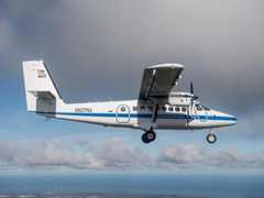
The Coastal and Ocean Airborne Science Testbed (COAST) was a NASA project that utilized remote sensing techniques to improve understanding of the optically complex coastal zone. COAST had one deployment in October 2011 near Monterey Bay, California. The CIRPAS Twin Otter was equipped with sensors such as the Headwall Imaging Spectrometer (HIS) and Airborne Tracking Sun Photometer (ATSP) to gather remote sensing observations of coastal ecosystems. The R/V John Martin was also used to collect data using a sun photometer and radiometers. COAST was funded by NASA’s Hands-On Project Experience (HOPE) Training Opportunity Award under the guidance of NASA’s Science Mission Directorate (SMD) and Office of the Chief Engineer.
N: 38°N
S: 36°N
W: 124°W
E: 121°W
no campaign DOI available
- COAST Project Website (ASP)
- COAST Conference Paper
Additional Notes
Repositories
Unpublished
Events


