Back to Explore
High Winds
Global Water & Energy Cycle
- 1
- Deployment
2009-02-16 2009-03-09 - 1
- Platforms
- 0
- Data Products
The Campaign
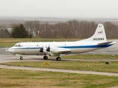
High Winds was a NASA field campaign aimed at collecting passive and active microwave measurements during high wind conditions over the ocean to calibrate and validate satellite observations. It was based in Goose Bay, Canada, from February to March 2009. The NASA P-3 aircraft was equipped with the Passive and Active L-band System (PALS) and the Polarimetric Scatterometer (PolSCAT) to gather measurements of ocean surface winds over the North Atlantic Ocean and Labrador Sea. High Winds was funded through the NASA Terrestrial Hydrology Program.
HOW, PALS HOW, High Ocean Winds
2009-02-16 — 2009-03-09
Labrador Sea, North Atlantic Ocean
boreal spring, boreal winter, cold
N: 55°N
S: 40°N
W: 60°W
E: 35°W
no campaign DOI available
- Overview of observations during the High Winds campaign
- Airborne Science Program 2009 Annual Report
Additional Notes
Repositories
Unpublished
Events
1 Deployment
1 IOP
NASA
Terrestrial Hydrology Program
Jared Entin
Steven Dinardo
Currently unavailable
Unpublished
Currently unavailable
