
Operation IceBridge
Climate Variability & Change
- 37
- view all deployment datesDeployments
2009-10-16 2010-02-16 2009-03-31 2009-06-02 2009-08-19 2009-09-06 2010-03-22 2010-05-26 2010-08-21 2010-08-29 2010-10-20 2011-02-26 2011-03-16 2011-05-30 2011-08-16 2011-09-12 2011-10-07 2011-12-23 2012-03-14 2012-05-24 2012-08-14 2012-08-30 2012-10-12 2013-01-26 2013-03-20 2013-05-28 2013-06-17 2013-08-30 2013-10-31 2013-11-14 2013-11-19 2013-11-28 2014-03-12 2014-05-24 2014-08-19 2014-08-23 2014-10-16 2014-11-22 2015-03-19 2015-05-22 2015-08-20 2015-08-29 2015-09-22 2015-10-29 2015-09-23 2015-10-22 2016-04-19 2016-05-28 2016-07-13 2016-09-15 2016-10-14 2016-11-18 2017-03-09 2017-05-31 2017-07-17 2017-09-20 2017-10-29 2017-12-16 2018-03-22 2018-05-30 2018-08-17 2018-08-29 2018-10-10 2018-11-16 2019-04-03 2019-05-16 2019-09-04 2019-09-28 2019-10-23 2019-11-20 2020-05-21 2020-06-13 2021-05-02 2021-05-13 - 10
- Platforms
- 79
- Data Products
The Campaign
NASA’s Operation IceBridge was a large-scale airborne investigation designed to fill the gap in polar observations between the ICESat and ICESat-2 satellite missions. IceBridge involved multiple deployments from 2009 to 2021 across Greenland, Alaska, Antarctica, and the Arctic Sea. More than 1,000 aircraft surveys were conducted using various remote sensors, such as the Airborne Topographic Mapper (ATM), the Digital Mapping System (DMS), and the Land Vegetation and Ice Sensor (LVIS), to map sea ice and topography in polar coastal regions. IceBridge was funded through NASA’s Cryospheric Sciences Program.
OIB
N: 85°N
S: 85°S
W: 180°W
E: 180°E
Additional Notes
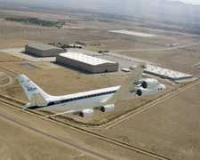
Douglas DC-8
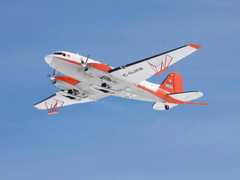
Basler BT-67
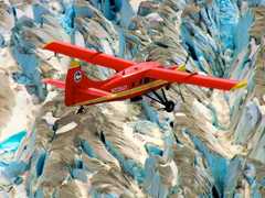
DeHavilland DHC-3 Otter
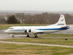
P-3 Orion

Douglas DC-8

P-3 Orion

Basler BT-67

Basler BT-67

P-3 Orion
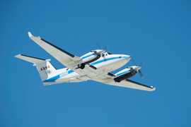
Beechcraft B-200 King Air

Douglas DC-8

Basler BT-67

Gulfstream-V
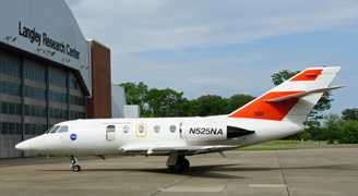
HU-25 Guardian

P-3 Orion

DeHavilland DHC-3 Otter

P-3 Orion

DeHavilland DHC-3 Otter
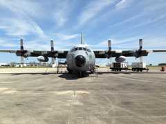
C-130 Hercules

DeHavilland DHC-3 Otter

C-130 Hercules

Gulfstream-V

HU-25 Guardian

P-3 Orion
Heli-Greenland AS350

HU-25 Guardian

P-3 Orion

Basler BT-67

DeHavilland DHC-3 Otter

P-3 Orion

Douglas DC-8

P-3 Orion

DeHavilland DHC-3 Otter

Gulfstream-V

Gulfstream-V

Cessna 206H Stationair
Events
Filter data products from this campaign by specific platforms, instruments, or formats.
