Plankton, Aerosol, Cloud, ocean Ecosystem Postlaunch Airborne eXperiment
Atmospheric Composition, Carbon Cycle & Ecosystems, Climate Variability & Change
- 1
- view all deployment datesDeployment
2024-08-28 2024-09-30 - 5
- Platforms
- 14
- Data Products
The Campaign
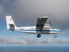
The Plankton, Aerosol, Cloud, ocean Ecosystem Postlaunch Airborne eXperiment (PACE-PAX) was a NASA field campaign aimed at supporting data validation for the PACE satellite. PACE-PAX included a single deployment in September 2024 over Southern and Central California and nearby coastal regions. The NASA ER-2 was equipped with remote sensing sensors, and the CIRPAS Twin Otter had in situ sensors to collect measurements of ocean, aerosol, and cloud properties. Additional ground-based and shipborne measurements were also gathered. PACE-PAX was funded by NASA’s Ocean Biology and Biogeochemistry Program.
N: 40°N
S: 30°N
W: 124°W
E: 110°W
Additional Notes
Repositories

NASA Earth Resources-2 Aircraft

DeHavilland DHC-6-300 Twin Otter

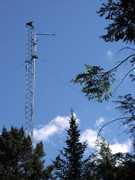
Permanent Land Site
R/V Shearwater
R/V Blissfully
Events
Filter data products from this campaign by specific platforms, instruments, or formats.
