Satellite Coastal and Oceanic Atmospheric Pollution Experiment
Atmospheric Composition
- 2
- view all deployment datesDeployments
2019-04-09 2019-05-20 2024-06-02 2024-06-13 - 4
- Platforms
- 6
- Data Products
The Campaign
The Satellite Coastal and Oceanic Atmospheric Pollution Experiment (SCOAPE) was a field campaign focused on evaluating satellite data for monitoring air quality and emissions from oil and gas plumes. SCOAPE included two deployments in the Gulf of Mexico, one in May 2019 and the other in June 2024. During both deployments, the R/V Point Sur collected trace gas and aerosol measurements, with ground-based data gathered in 2019 to study offshore pollution. In the 2024 deployment, the Airborne Visible Infrared Imaging Spectrometer 3 (AVIRIS-3) captured hyperspectral imagery for satellite validation. SCOAPE was funded by NASA’s Applied Sciences Program, with support from the U.S. Department of the Interior and the Bureau of Ocean Energy Management (BOEM).
N: 31°N
S: 25°N
W: 95°W
E: 85°W
no campaign DOI available
- Project Website for SCOAPE
- ASDC Landing Page for SCOAPE
Additional Notes
Repositories
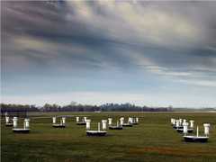
Field Site
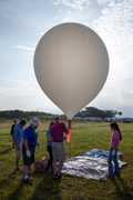
Balloon Launch Site
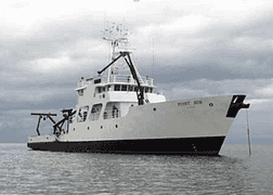
R/V Point Sur

R/V Point Sur
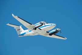
Beechcraft B-200 King Air

Balloon Launch Site
Events
Filter data products from this campaign by specific platforms, instruments, or formats.
