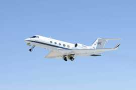
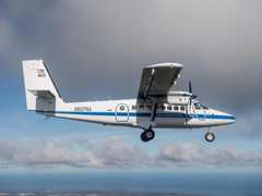
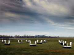
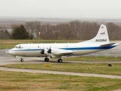
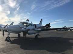
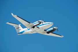
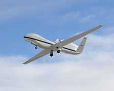
SnowEx is a multi-year, NASA-led campaign that aims to improve remote sensing capabilities of snow in forested areas. SnowEx has completed four deployments during the boreal winter from 2016 to 2023, mainly in Colorado and Alaska for 2023. Several aircraft equipped with radars, radiometers, and other remote sensing tools, along with ground instruments, were used to record changes in snow and ice accumulation, as well as meteorological data such as snowfall rates. SnowEx is funded by NASA’s Terrestrial Hydrology Program.
The Airborne Glacier and Land Ice Surface Topography Interferometer (GLISTIN-A) is an airborne interferometric synthetic aperture radar. GLISTIN-A operates in the Ka-band (35.6 GHz), which allows the instrument to penetrate the top layers of snow and reduces atmospheric attenuation. GLISTIN-A provides measurements of glacial and land ice surface topography and elevation with a spatial resolution of about 3 meters. It is ideal for measuring ice sheet elevation and studying glacial topographic changes due to its high spatial resolution and accuracy.
The Wideband Instrument for Snow Measurements (WISM) instrument was developed to address a remote sensing need to measure surface snowfall and its associated snow water equivalent. WISM consists of two airborne instruments: a dual-frequency (X and Ku) Synthetic Aperture Radar and a dual-frequency (X and Ka) radiometer with a shared common antenna aperture between the two.
Earth Science > Atmosphere > Precipitation > Snow Water Equivalent
The Riegl VZ-1000 is a ground-based terrestrial laser scanner manufactured by Riegl Laser Measurement Systems. It provides lidar point cloud measurements to determine surface topography features. It operates at a 1550 nm wavelength and has a scan rate of up to 122,000 points per second. It has a maximum scan range of 1.4 km and a resolution of 2 cm.
Earth Science > Land Surface > Topography > Terrain Elevation
Generic-Atmospheric State (Gen-AtmsState) refers to non-specific instruments on a platform used for measurements of atmospheric state parameters. These are typically in situ sensors that measure temperature, pressure, humidity, and wind speed/direction. Types of atmospheric state instruments include thermometers, hygrometers, barometers, and anemometers.
Earth Science > Atmosphere > Atmospheric Water Vapor
Earth Science > Atmosphere > Atmospheric Pressure
Earth Science > Atmosphere > Atmospheric Water Vapor > Water Vapor Indicators > Humidity
Earth Science > Atmosphere > Atmospheric Temperature > Surface Temperature > Air Temperature
The University of Waterloo Scatterometer (UW-Scat) is a ground-based polarimetric scatterometer used for observations of snow and ice properties. It consists of two scatterometers operating at the Ku-band (17.2 GHz) and X-band (9.6 GHz) frequencies to detect radar backscatter. These measurements are used to derive snow and ice properties, such as snow water equivalent (SWE). UW-Scat has a range resolution of 30 cm and a half-power beam width of 5.6 and 4.3 degrees at Ku-band and X-band, respectively. A full scan of UW-Scat takes approximately 24 minutes to complete.
Generic-Radiometers refer to non-specific radiometers on a platform. These are typically passive microwave radiometers that measure brightness temperature. Radiometers can be used to retrieve temperature and water vapor profiles, soil moisture content, ocean salinity, precipitation and cloud properties, and vegetation.
Earth Science > Spectral/engineering > Microwave > Brightness Temperature
A snow measuring rod is a ground-based instrument used to measure snow depth. It is designed to be pushed into the snow until the underlying surface is reached to determine the snow depth. Snow measuring rods can be manual or automated, with the automated rod able to measure the depth and position simultaneously.
Digital cameras are used to provide imagery for research applications. Cameras are used on aircraft to collect aerial imagery for mapping and surveying, environmental monitoring, cloud observations, agriculture, geological studies, and other Earth science applications. They are also used at field sites to capture visual observations to monitor changes in land cover, vegetation, clouds, air quality, glaciers, and other phenomena.
The SnowMicroPen (SMP) is a ground-based snow penetrometer operated by the WSL Institute for Snow and Avalanche Research SLF. It measures the penetration resistance of snowpacks using a piezoelectric force sensor. These measurements help determine microstructural parameters, snow stratigraphy, and snow properties such as density and surface area. SMP typically can measure snow depths up to 1.25 m with a vertical resolution of less than 1 mm.
The Leica ScanStation C10 is a ground-based high-definition surveying (HDS) scanner manufactured by Leica Geosystems. It provides terrestrial lidar scanning (TLS) point cloud measurements to determine canopy structure and surface topography. It operates at 532 nm wavelength and has a scan rate of up to 50,000 points per second. It has a range resolution of 130 to 300 m, depending on the albedo of the surface.
Earth Science > Land Surface > Topography > Terrain Elevation
The Quantum Well Infrared Photodetector (QWIP) is an airborne infrared camera system manufactured by QmagiQ and operated by the NASA Goddard Space Flight Center (GSFC). QWIP collects infrared imagery in the 8-10 μm band and can detect temperature variations of around 0.2 degrees Celsius. It has a typical frame rate of 60 Hz and a field of view of 11 by 9 degrees. QWIP has a pixel ground resolution of approximately 1.8 m at a flight altitude of 10000 feet.
The Snow Synthetic Aperture Radar (SnowSAR) is an airborne dual-frequency, dual-polarization SAR developed by MetaSensing for the European Space Agency (ESA). It captures radar images of snow, ice, and other vegetation for satellite validation. SnowSAR operates on X-band (9.6 GHz) and Ku-band (17.25 GHz) frequencies. It has a swath width ranging from 200 to 2000 meters and a typical spatial resolution of 1 meter by 1 meter.
The Cloud Absorption Radiometer (CAR) is an airborne multichannel scanning radiometer developed by the Goddard Space Flight Center (GSFC). CAR provides measurements of scattered radiance and bidirectional surface reflectance across 14 spectral bands in the visible and near-infrared wavelengths (0.34-2.30 µm). It also captures imagery of cloud and surface features on Earth. CAR has a scan rate of 1.67 Hz (100 rpm) and a spatial resolution of 4 meters at nadir, at an altitude of 200 meters above ground.
Earth Science > Atmosphere > Clouds > Cloud Radiative Transfer
A pyrometer is a remote-sensing infrared thermometer that measures the temperature of distant objects. It determines an object's temperature by detecting its thermal radiation. It can be mounted on aircraft, ground vehicles, or water-based platforms for surface and sea surface temperature observations. For atmospheric studies, the pyrometer usually operates in the 9.6 to 11.5 µm spectral range and has a temperature range of -25 to 200 degrees Celsius. Pyrometers typically have a response time between 5 milliseconds and 600 seconds.
Earth Science > Oceans > Ocean Temperature > Sea Surface Temperature
Earth Science > Atmosphere > Atmospheric Temperature > Surface Temperature > Skin Temperature
Earth Science > Atmosphere > Atmospheric Temperature > Surface Temperature
Earth Science > Spectral/engineering > Infrared Wavelengths > Brightness Temperature
Video cameras capture video recordings of various phenomena for research purposes. They are used on aircraft to provide continuous views of weather and terrain below the flight path. Video cameras are also employed to verify the aircraft's flight track. Additionally, they are deployed at field sites to monitor changes in vegetation, land cover, clouds, air quality, glaciers, and other Earth science phenomena.
The Airborne Snow Observatory (ASO) is an airborne system of remote sensing instruments used to measure snow properties such as snow albedo, snow depth, and snow water equivalent. ASO includes a CASI 1500 imaging spectrometer and a Riegl Q1560 scanning lidar. The CASI spectrometer operates across the 380-1050 nm range and is employed to retrieve spectral albedo. The Riegl Q1560 lidar functions at the 1064 nm wavelength and measures surface elevation to determine snow depths. Snow depth measurements are provided at spatial resolutions of 3m and 50m, while snow water equivalent measurements are available only at a 50m resolution.
Earth Science > Cryosphere > Snow/ice > Albedo
Earth Science > Atmosphere > Precipitation > Snow Water Equivalent
The Airborne Glacier and Land Ice Surface Topography Interferometer (GLISTIN-A) is an airborne interferometric synthetic aperture radar. GLISTIN-A operates in the Ka-band (35.6 GHz), which allows the instrument to penetrate the top layers of snow and reduces atmospheric attenuation. GLISTIN-A provides measurements of glacial and land ice surface topography and elevation with a spatial resolution of about 3 meters. It is ideal for measuring ice sheet elevation and studying glacial topographic changes due to its high spatial resolution and accuracy.
The Uninhabited Aerial Vehicle Synthetic Aperture Radar (UAVSAR) is an airborne polarimetric L-band radar developed and operated by the Jet Propulsion Laboratory (JPL). It provides differential interferometric measurements that can be used to understand deformation caused by phenomena such as earthquakes, volcanoes, and glaciers. UAVSAR operates at a frequency of 1.26 GHz and has a range bandwidth of 80 MHz. It features a horizontal resolution of 6 meters and a swath width of 20 kilometers at an altitude of 12 kilometers.
The Snow Water Equivalent Synthetic Aperture Radar and Radiometer (SWESARR) is an airborne remote sensor developed at NASA’s Goddard Space Flight Center (GSFC). It consists of a synthetic aperture radar (SAR) and a microwave radiometer for retrievals of snow water equivalent (SWE). The SAR instrument measures radar backscatter across three frequency bands: 9.65, 13.6, and 17.25 GHz. It has a nominal range resolution of 1.1 m and a swath width of about 250 to 450 m, depending on the operating frequency. The radiometer measures brightness temperature across three frequency bands: 10.65, 18.7, and 36.5 GHz. At a nominal altitude of 1500 m, it has a spatial resolution of 496 x 353 m, 282 x 200 m, and 144 x 102 m for the X-band, K-band, and Ka-band frequencies, respectively.
The Compact Airborne System for Imaging the Environment (CASIE) is an airborne suite of remote imaging sensors operated by the University of Washington Applied Physics Laboratory (APL). It includes three thermal infrared (TIR) cameras, a longwave radiometer, a visible band camera to gather infrared and visible imagery, and radiometric measurements for mapping snow, land, and tree surface temperature brightness. The TIR cameras operate in the 8-14 μm spectral range, capturing imagery at 5 Hz with a spatial resolution of 1 to 2 meters. The longwave radiometer operates in the 9.6-11.5 μm spectral region, measuring brightness temperature at 30 Hz with a spatial resolution of 50 meters. The visible band camera records imagery in the 400-700 nm range at 2 Hz with a spatial resolution of 5 meters.
Generic-Atmospheric State (Gen-AtmsState) refers to non-specific instruments on a platform used for measurements of atmospheric state parameters. These are typically in situ sensors that measure temperature, pressure, humidity, and wind speed/direction. Types of atmospheric state instruments include thermometers, hygrometers, barometers, and anemometers.
Earth Science > Atmosphere > Atmospheric Water Vapor
Earth Science > Atmosphere > Atmospheric Pressure
Earth Science > Atmosphere > Atmospheric Water Vapor > Water Vapor Indicators > Humidity
Earth Science > Atmosphere > Atmospheric Temperature > Surface Temperature > Air Temperature
Soil moisture probes are in situ ground-based sensors that measure soil water content. The most common type of soil moisture probes used for scientific research use dielectric permittivity techniques, such as capacitance or time-domain reflectometry sensors. These types of probes measure the charge-storage capacity of the soil to determine the soil moisture content. They typically operate at frequencies around 50 MHz and above to reduce sensitivity to salinity. Soil moisture probes provide continuous measurements and are relatively easy to deploy.
Ground penetrating radar (GPR) is an electromagnetic geophysical technique used to image the subsurface. It transmits radio wave pulses to detect returning signals, which help determine the depth and size of subsurface targets. GPR generally operates in the 10 to 1000 MHz frequency range and can reach depths of about 10 to 100 meters, depending on the surface. In Earth science, GPR is used to measure ice thickness, soil layers, groundwater levels, bedrock depth, water depth, rock fractures, and various other applications.
The Riegl VZ-1000 is a ground-based terrestrial laser scanner manufactured by Riegl Laser Measurement Systems. It provides lidar point cloud measurements to determine surface topography features. It operates at a 1550 nm wavelength and has a scan rate of up to 122,000 points per second. It has a maximum scan range of 1.4 km and a resolution of 2 cm.
Earth Science > Land Surface > Topography > Terrain Elevation
Digital cameras are used to provide imagery for research applications. Cameras are used on aircraft to collect aerial imagery for mapping and surveying, environmental monitoring, cloud observations, agriculture, geological studies, and other Earth science applications. They are also used at field sites to capture visual observations to monitor changes in land cover, vegetation, clouds, air quality, glaciers, and other phenomena.
Soil temperature sensors are in situ ground-based sensors used to measure and monitor soil temperature. They measure soil temperature by using thermistors or thermocouples to detect changes in resistance to calculate the temperature. Soil temperature sensors are used for agricultural purposes, environmental monitoring, and ecological research.
Earth Science > Agriculture > Soils
Earth Science > Climate Indicators > Land Surface/agriculture Indicators > Soil Temperature
Earth Science > Land Surface > Frozen Ground > Soil Temperature
Earth Science > Agriculture > Soils > Soil Temperature
Earth Science > Land Surface > Soils
Earth Science > Cryosphere > Frozen Ground > Soil Temperature
Earth Science > Land Surface > Soils > Soil Temperature
The SnowMicroPen (SMP) is a ground-based snow penetrometer operated by the WSL Institute for Snow and Avalanche Research SLF. It measures the penetration resistance of snowpacks using a piezoelectric force sensor. These measurements help determine microstructural parameters, snow stratigraphy, and snow properties such as density and surface area. SMP typically can measure snow depths up to 1.25 m with a vertical resolution of less than 1 mm.
Generic-Radiometers refer to non-specific radiometers on a platform. These are typically passive microwave radiometers that measure brightness temperature. Radiometers can be used to retrieve temperature and water vapor profiles, soil moisture content, ocean salinity, precipitation and cloud properties, and vegetation.
Earth Science > Spectral/engineering > Microwave > Brightness Temperature
The Leica ScanStation C10 is a ground-based high-definition surveying (HDS) scanner manufactured by Leica Geosystems. It provides terrestrial lidar scanning (TLS) point cloud measurements to determine canopy structure and surface topography. It operates at 532 nm wavelength and has a scan rate of up to 50,000 points per second. It has a range resolution of 130 to 300 m, depending on the albedo of the surface.
Earth Science > Land Surface > Topography > Terrain Elevation
The Airborne Snow Observatory (ASO) is an airborne system of remote sensing instruments used to measure snow properties such as snow albedo, snow depth, and snow water equivalent. ASO includes a CASI 1500 imaging spectrometer and a Riegl Q1560 scanning lidar. The CASI spectrometer operates across the 380-1050 nm range and is employed to retrieve spectral albedo. The Riegl Q1560 lidar functions at the 1064 nm wavelength and measures surface elevation to determine snow depths. Snow depth measurements are provided at spatial resolutions of 3m and 50m, while snow water equivalent measurements are available only at a 50m resolution.
Earth Science > Cryosphere > Snow/ice > Albedo
Earth Science > Atmosphere > Precipitation > Snow Water Equivalent
The Compact Airborne Spectrographic Imager (CASI) is an airborne push-broom imaging spectrometer developed by Itres Research Ltd. CASI measures reflectance in the visible/near-infrared (VNIR) spectral region, which can be used to derive vegetation characteristics. It operates in the 430-870 nm spectral range and has a 35-degree field of view (FOV). CASI has a cross-track ground resolution of 1.23 meters at 1 km altitude above ground level (AGL). The along-track resolution depends on the integration time and the aircraft speed. CASI has a frame rate of 85 lines per second.
Earth Science > Biosphere > Vegetation > Vegetation Index > Leaf Area Index (lai)
Riegl Airborne Laser Scanners are airborne lidar systems produced by Riegl Laser Measurement Systems. They are commonly used for topographic mapping of glacial, agricultural, urban, and geological regions. Operating mainly in the near-infrared wavelength, they can function at altitudes up to about 14,000 feet, with a field of view approximately 60 to 75 degrees, and measurement rates reaching around 3 MHz, depending on the lidar system.
The Snow Water Equivalent Synthetic Aperture Radar and Radiometer (SWESARR) is an airborne remote sensor developed at NASA’s Goddard Space Flight Center (GSFC). It consists of a synthetic aperture radar (SAR) and a microwave radiometer for retrievals of snow water equivalent (SWE). The SAR instrument measures radar backscatter across three frequency bands: 9.65, 13.6, and 17.25 GHz. It has a nominal range resolution of 1.1 m and a swath width of about 250 to 450 m, depending on the operating frequency. The radiometer measures brightness temperature across three frequency bands: 10.65, 18.7, and 36.5 GHz. At a nominal altitude of 1500 m, it has a spatial resolution of 496 x 353 m, 282 x 200 m, and 144 x 102 m for the X-band, K-band, and Ka-band frequencies, respectively.
Riegl Airborne Laser Scanners are airborne lidar systems produced by Riegl Laser Measurement Systems. They are commonly used for topographic mapping of glacial, agricultural, urban, and geological regions. Operating mainly in the near-infrared wavelength, they can function at altitudes up to about 14,000 feet, with a field of view approximately 60 to 75 degrees, and measurement rates reaching around 3 MHz, depending on the lidar system.
Generic-Atmospheric State (Gen-AtmsState) refers to non-specific instruments on a platform used for measurements of atmospheric state parameters. These are typically in situ sensors that measure temperature, pressure, humidity, and wind speed/direction. Types of atmospheric state instruments include thermometers, hygrometers, barometers, and anemometers.
Earth Science > Atmosphere > Atmospheric Water Vapor
Earth Science > Atmosphere > Atmospheric Pressure
Earth Science > Atmosphere > Atmospheric Water Vapor > Water Vapor Indicators > Humidity
Earth Science > Atmosphere > Atmospheric Temperature > Surface Temperature > Air Temperature
Ground penetrating radar (GPR) is an electromagnetic geophysical technique used to image the subsurface. It transmits radio wave pulses to detect returning signals, which help determine the depth and size of subsurface targets. GPR generally operates in the 10 to 1000 MHz frequency range and can reach depths of about 10 to 100 meters, depending on the surface. In Earth science, GPR is used to measure ice thickness, soil layers, groundwater levels, bedrock depth, water depth, rock fractures, and various other applications.
Generic-Radiometers refer to non-specific radiometers on a platform. These are typically passive microwave radiometers that measure brightness temperature. Radiometers can be used to retrieve temperature and water vapor profiles, soil moisture content, ocean salinity, precipitation and cloud properties, and vegetation.
Earth Science > Spectral/engineering > Microwave > Brightness Temperature
The Riegl VZ-1000 is a ground-based terrestrial laser scanner manufactured by Riegl Laser Measurement Systems. It provides lidar point cloud measurements to determine surface topography features. It operates at a 1550 nm wavelength and has a scan rate of up to 122,000 points per second. It has a maximum scan range of 1.4 km and a resolution of 2 cm.
Earth Science > Land Surface > Topography > Terrain Elevation
Digital cameras are used to provide imagery for research applications. Cameras are used on aircraft to collect aerial imagery for mapping and surveying, environmental monitoring, cloud observations, agriculture, geological studies, and other Earth science applications. They are also used at field sites to capture visual observations to monitor changes in land cover, vegetation, clouds, air quality, glaciers, and other phenomena.
The SnowMicroPen (SMP) is a ground-based snow penetrometer operated by the WSL Institute for Snow and Avalanche Research SLF. It measures the penetration resistance of snowpacks using a piezoelectric force sensor. These measurements help determine microstructural parameters, snow stratigraphy, and snow properties such as density and surface area. SMP typically can measure snow depths up to 1.25 m with a vertical resolution of less than 1 mm.
C-band radars operate within the 4-8 GHz frequency range. They provide measurements of radar reflectivity, Doppler velocity, and other parameters to characterize precipitation and clouds. C-band radars are usually used for short-range weather observations because they are more prone to attenuation.
A snow measuring rod is a ground-based instrument used to measure snow depth. It is designed to be pushed into the snow until the underlying surface is reached to determine the snow depth. Snow measuring rods can be manual or automated, with the automated rod able to measure the depth and position simultaneously.
The Airborne Visible InfraRed Imaging Spectrometer—Next Generation (AVIRIS-NG) is an airborne imaging spectrometer developed by the Jet Propulsion Laboratory (JPL). It captures visible and infrared imagery primarily used for terrestrial ecology research. It operates between 380 and 2510 nm at a spectral resolution of 5 nm. It has a horizontal resolution of 8 m and a swath width of 4 km at an altitude of 8 km. Its measurement frequency is 100 Hz. It was designed to replace the AVIRIS Classic (AVIRIS-C).
The Riegl Uncrewed Aerial Vehicle (UAV) Lidar Sensors are lidar systems made by Riegl Laser Measurement Systems, designed for use on UAVs. These sensors are more compact and lightweight than Riegl's airborne lidar systems. They are commonly used for topographic mapping in remote areas for agricultural, forestry, and geological applications. They can have a field of view up to 360 degrees, scan speeds of up to 200 scans per second, and an accuracy of 10 mm.
Digital cameras are used to provide imagery for research applications. Cameras are used on aircraft to collect aerial imagery for mapping and surveying, environmental monitoring, cloud observations, agriculture, geological studies, and other Earth science applications. They are also used at field sites to capture visual observations to monitor changes in land cover, vegetation, clouds, air quality, glaciers, and other phenomena.
Generic-Atmospheric State (Gen-AtmsState) refers to non-specific instruments on a platform used for measurements of atmospheric state parameters. These are typically in situ sensors that measure temperature, pressure, humidity, and wind speed/direction. Types of atmospheric state instruments include thermometers, hygrometers, barometers, and anemometers.
Earth Science > Atmosphere > Atmospheric Water Vapor
Earth Science > Atmosphere > Atmospheric Pressure
Earth Science > Atmosphere > Atmospheric Water Vapor > Water Vapor Indicators > Humidity
Earth Science > Atmosphere > Atmospheric Temperature > Surface Temperature > Air Temperature
Soil moisture probes are in situ ground-based sensors that measure soil water content. The most common type of soil moisture probes used for scientific research use dielectric permittivity techniques, such as capacitance or time-domain reflectometry sensors. These types of probes measure the charge-storage capacity of the soil to determine the soil moisture content. They typically operate at frequencies around 50 MHz and above to reduce sensitivity to salinity. Soil moisture probes provide continuous measurements and are relatively easy to deploy.
Ground penetrating radar (GPR) is an electromagnetic geophysical technique used to image the subsurface. It transmits radio wave pulses to detect returning signals, which help determine the depth and size of subsurface targets. GPR generally operates in the 10 to 1000 MHz frequency range and can reach depths of about 10 to 100 meters, depending on the surface. In Earth science, GPR is used to measure ice thickness, soil layers, groundwater levels, bedrock depth, water depth, rock fractures, and various other applications.
Generic-Radiometers refer to non-specific radiometers on a platform. These are typically passive microwave radiometers that measure brightness temperature. Radiometers can be used to retrieve temperature and water vapor profiles, soil moisture content, ocean salinity, precipitation and cloud properties, and vegetation.
Earth Science > Spectral/engineering > Microwave > Brightness Temperature
The Riegl VZ-1000 is a ground-based terrestrial laser scanner manufactured by Riegl Laser Measurement Systems. It provides lidar point cloud measurements to determine surface topography features. It operates at a 1550 nm wavelength and has a scan rate of up to 122,000 points per second. It has a maximum scan range of 1.4 km and a resolution of 2 cm.
Earth Science > Land Surface > Topography > Terrain Elevation
Digital cameras are used to provide imagery for research applications. Cameras are used on aircraft to collect aerial imagery for mapping and surveying, environmental monitoring, cloud observations, agriculture, geological studies, and other Earth science applications. They are also used at field sites to capture visual observations to monitor changes in land cover, vegetation, clouds, air quality, glaciers, and other phenomena.
Soil temperature sensors are in situ ground-based sensors used to measure and monitor soil temperature. They measure soil temperature by using thermistors or thermocouples to detect changes in resistance to calculate the temperature. Soil temperature sensors are used for agricultural purposes, environmental monitoring, and ecological research.
Earth Science > Agriculture > Soils
Earth Science > Climate Indicators > Land Surface/agriculture Indicators > Soil Temperature
Earth Science > Land Surface > Frozen Ground > Soil Temperature
Earth Science > Agriculture > Soils > Soil Temperature
Earth Science > Land Surface > Soils
Earth Science > Cryosphere > Frozen Ground > Soil Temperature
Earth Science > Land Surface > Soils > Soil Temperature
The SnowMicroPen (SMP) is a ground-based snow penetrometer operated by the WSL Institute for Snow and Avalanche Research SLF. It measures the penetration resistance of snowpacks using a piezoelectric force sensor. These measurements help determine microstructural parameters, snow stratigraphy, and snow properties such as density and surface area. SMP typically can measure snow depths up to 1.25 m with a vertical resolution of less than 1 mm.