Westcoast & Heartland Hyperspectral Microwave Sensor Intensive Experiment
Weather
- 1
- Deployment
2024-10-17 2024-11-18 - 2
- Platforms
- 0
- Data Products
The Campaign
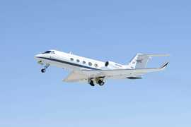
The Westcoast & Heartland Hyperspectral Microwave Sensor Intensive Experiment (WHyMSIE) was a field campaign conducted by NASA and NOAA. It examined the thermodynamics and development of the planetary boundary layer (PBL) to improve PBL observations and to advance the establishment of a comprehensive PBL observing system. WHyMSIE took place from October to November 2024 across the western United States and Great Plains. The NASA ER-2 was equipped with various instruments, including the Conical Scanning Millimeter-wave Imaging Radiometer - Hyperspectral (CoSMIR-H), Airborne Radio Occultation (ARO), and Microwave Barometric Radar and Sounder (MBARS), to collect profile measurements of temperature, winds, water vapor, and cloud properties. A complementary validation experiment, the Active and Passive Profiling EXperiment (APEX), also deployed the High Altitude Lidar Observatory (HALO) and the Aerosol Doppler Wind Radar (AWR) aboard the G-III aircraft. WHyMSIE flew over the ARM Southern Great Plains (SGP) Central Facility (CF) to gather ground-based validation data. WHyMSIE was funded by NASA's Earth Science Technology Office (ESTO) and the Decadal Survey Incubation (DSI) Program.
N: 50°N
S: 25°N
W: 140°W
E: 90°W
Additional Notes
Repositories
data center outside NASA
other NASA repository not formally considered a DAAC by ESDS
Events


