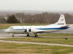
The Airborne Earth Science Microwave Imaging Radiometer (AESMIR) is an airborne microwave radiometer developed by Goddard Space Flight Center (GSFC). It measures brightness temperature across six microwave bands: 6.9, 10.7, 18.7, 23.8, 36.5, and 89 GHz. These measurements support analysis of precipitation, snow, soil moisture, ocean winds, sea ice, sea surface temperature, and vegetation. AESMIR has been configured to simulate multiple satellite radiometers, including the Advanced Microwave Scanning Radiometer for EOS (AMSR-E), the Special Sensor Microwave Imager Sounder (SSMIS), the GPM Microwave Imager, and the Advanced Technology Microwave Sounder (ATMS).

Instrument Details
- Spectrometer/Radiometer
- Earth Science > Spectral/engineering > Microwave > Brightness TemperatureEarth Science > Spectral/engineering > Microwave > Microwave Imagery
- Land Surface
- N/A
- N/A
- 6.9 GHz, 10.7 GHz, 18.7 GHz, 23.8 GHz, 36.5 GHz, 89 GHz
- Currently unavailable
Edward Kim
Edward Kim
GSFC
NASA
Currently unavailable
Unpublished
 P-3 Orion 30 Campaigns · 153 Instruments | CLPX Cold Land Processes Experiment 2002—2008 Central Rocky Mountains, Colorado, Alaska 2 Deployments · 0 Data Products
|