The Airborne Inertially Referenced Gravimeter (AIRGrav) is an airborne gravimeter developed by Sanders Geophysics Limited. It uses three orthogonal accelerometers mounted on an inertially stabilized platform to measure gravity and gravity anomalies. AIRGrav is primarily used for gravity surveys in gas- and oil-producing regions, but it has also been employed in surveys over polar and coastal areas. AIRGrav provides a typical spatial resolution of 2 km and collects data at a rate of 128 Hz.
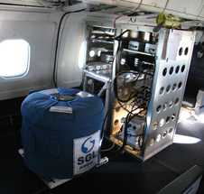

Instrument Details
- Magnetic/Electric
- Earth Science > Solid Earth > Gravity/gravitational Field > Gravity AnomaliesEarth Science > Oceans > Bathymetry/seafloor Topography > BathymetryEarth Science > Solid Earth > Gravity/gravitational FieldEarth Science > Solid Earth > Gravity/gravitational Field > Gravity
- Land Surface
- 128 Hz
- 2 km
- N/A
- Currently unavailable
Stephan Sanders
Stephan Sanders
Sander Geophysics Limited
Currently unavailable
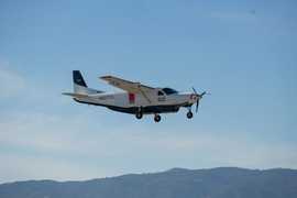 Cessna 208 Grand Caravan 1 Campaign · 1 Instrument |  Oceans Melting Greenland 2015—2021 Greenland 14 Deployments · 11 Data Products
| ||||||||||||||||||||||||||||||||||||||||||||||||||||||||||||||||||||||||||||
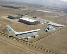 Douglas DC-8 45 Campaigns · 182 Instruments |  Operation IceBridge 2009—2021 Greenland, Antarctica, Alaska, Arctic Sea 37 Deployments · 79 Data Products
| ||||||||||||||||||||||||||||||||||||||||||||||||||||||||||||||||||||||||||||
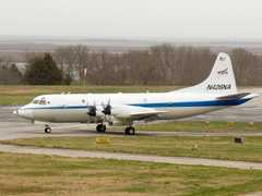 P-3 Orion 30 Campaigns · 153 Instruments |  Operation IceBridge 2009—2021 Greenland, Antarctica, Alaska, Arctic Sea 37 Deployments · 79 Data Products
| ||||||||||||||||||||||||||||||||||||||||||||||||||||||||||||||||||||||||||||
AS350 Heli-Greenland AS350 1 Campaign · 2 Instruments |  Operation IceBridge 2009—2021 Greenland, Antarctica, Alaska, Arctic Sea 37 Deployments · 79 Data Products
|
Filter data products from this instrument by specific campaigns, platforms, or formats.