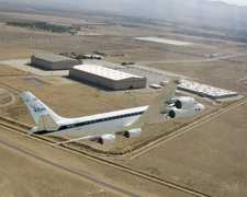
The Airborne Synthetic Aperture Radar (AIRSAR) was an airborne P-, L-, and C-band radar system developed by the Jet Propulsion Laboratory (JPL). It could penetrate clouds and operate at night to measure radar backscatter. It could also penetrate forest canopies, dry snow cover, and sand in two of its imaging modes. AIRSAR operated at three frequencies: 0.45 GHz, 1.26 GHz, and 5.31 GHz. It had a horizontal resolution of 10 meters and a swath width of about 10 to 15 kilometers at an altitude of 8,000 meters. AIRSAR is now retired, with its last mission in 2004.

Instrument Details
- Radar
- Earth Science > Spectral/engineering > Radar > Radar BackscatterEarth Science > Spectral/engineering > Radar > Radar Imagery
- Land Surface
- N/A
- 10 m
- 0.45 GHz, 1.26 GHz, 5.31 GHz
- https://nsidc.org/sites/default/files/the_nasajpl_airborne_synthetic_aperture_radar_system.pdf
Yunling Lou
Yunling Lou
JPL
NASA
Currently unavailable
 Douglas DC-8 45 Campaigns · 182 Instruments |  Boreal Ecosystem-Atmosphere Study 1994—1996 Boreal forests of central Canada 2 Deployments · 303 Data Products
OTTER Oregon Transect Ecosystem Research Project 1989—1991 western coniferous forest in Oregon 3 Deployments · 14 Data Products
CLPX Cold Land Processes Experiment 2002—2008 Central Rocky Mountains, Colorado, Alaska 2 Deployments · 0 Data Products
SMEX Soil Moisture Experiment 2002—2005 Iowa, Oklahoma, Georgia, Alabama, Arizona, Sonora, Mexico 4 Deployments · 0 Data Products
PacRim II Pacific Rim 2000 2000 South Pacific Region, United States 1 Deployment · 0 Data Products
|
Filter data products from this instrument by specific campaigns, platforms, or formats.