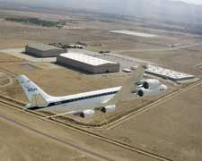
The Airborne Raman Lidar (ARL) is a lidar system developed by Goddard Space Flight Center (GSFC). It detects Rayleigh and Raman backscattering at 351 nm. These measurements are used to derive profiles of methane, water vapor, and temperature. ARL has a vertical resolution of 300 meters.

Instrument Details
- Lidar
- Earth Science > Spectral/engineering > Lidar > Lidar BackscatterEarth Science > Atmosphere > Atmospheric Chemistry > Carbon And Hydrocarbon Compounds > MethaneEarth Science > Atmosphere > Atmospheric Water VaporEarth Science > Spectral/engineering > LidarEarth Science > Atmosphere > Atmospheric Water Vapor > Water Vapor ProfilesEarth Science > Atmosphere > Atmospheric Temperature > Upper Air Temperature > Vertical ProfilesEarth Science > Atmosphere > Atmospheric Temperature
- Full Column Profile
- N/A
- 300 m
- 854.1 THz
- Currently unavailable
William Heaps, John Burris
William Heaps, John Burris
GSFC
Currently unavailable
Unpublished
 Douglas DC-8 45 Campaigns · 182 Instruments |  Tropical Ozone Transport Experiment – Vortex Ozone Transport Experiment 1995—1996 Pacific Ocean, Hawaii, Alaska, Iceland, Arctic, Arctic Ocean 1 Deployment · 10 Data Products
|
Filter data products from this instrument by specific campaigns, platforms, or formats.
CAMPAIGNS
PLATFORMS
FORMATS