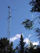
The Advanced Radar for Meteorological and Operational Research (ARMOR) is a dual-polarization C-band radar operated by the University of Alabama in Huntsville (UAH). It is located at the Huntsville International Airport. ARMOR transmits at 5625 MHz and has a beam width of 0.9 degrees. Its range-gate spacing is 125 m or 250 m, depending on the radar's scan mode. ARMOR originally served as a WSR-74C radar for the National Weather Service before being donated to UAH in 2002.

Instrument Details
- Radar
- Earth Science > Spectral/engineering > Radar > Doppler VelocityEarth Science > Spectral/engineering > Radar > Radar ReflectivityEarth Science > Spectral/engineering > Radar > Radial Velocity > Mean Radial VelocityEarth Science > Spectral/engineering > Radar > Radar ImageryEarth Science > Spectral/engineering > Radar > Radial VelocityEarth Science > Spectral/engineering > Radar > Spectrum Width
- Full Column Profile
- Variable
- 125m, 250m
- 5625 MHz
- Currently unavailable
Lawrence Carey
Lawrence Carey
Enterprise Electronics Corporation, Baron
WHNT, NOAA, NASA, TVA, NSF
Currently unavailable
data center outside NASA
 Permanent Land Site Stationary 63 Campaigns · 100 Instruments |  Deep Convective Clouds & Chemistry 2012 Northeastern Colorado, West Texas to Central Oklahoma, Northern Alabama 1 Deployment · 19 Data Products
|