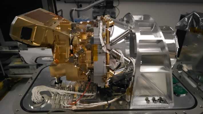
The Airborne Visible/Infrared Imaging Spectrometer 5 (AVIRIS-5) is an airborne imaging spectrometer developed at the Jet Propulsion Laboratory (JPL). It is identical in design to the Earth Surface Mineral Dust Source Investigation (EMIT) Imaging Spectrometer mounted on the International Space Station (ISS). It measures radiance and captures imagery across the 380-2500 nm spectral range with 425 channels at 5 nm spectral resolution. AVIRIS-5 has a spatial resolution of 8 meters.


Instrument Details
- Spectrometer/Radiometer
- Earth Science > Spectral/engineering > Visible Wavelengths > Visible RadianceEarth Science > Spectral/engineering > Visible Wavelengths > Visible ImageryEarth Science > Spectral/engineering > Infrared Wavelengths > Infrared RadianceEarth Science > Spectral/engineering > Infrared Wavelengths > Infrared Imagery
- Land Surface
- N/A
- 8 m
- 119.9-788.9 THz
- Currently unavailable
Robert O. Green
Robert O. Green
JPL
NASA
Currently unavailable
 NASA Earth Resources-2 Aircraft 63 Campaigns · 109 Instruments |  Geological Earth Mapping Experiment 2023—2026 Southwestern United States, California, Arizona, Nevada, New Mexico Ongoing 4 Deployments · 2 Data Products
WDTS Western Diversity Time Series 2020—2026 Southern California, Nevada, Pacific Ocean Ongoing 6 Deployments · 6 Data Products
|