The Airborne eXpendable BathyThermograph (AXBT) is an in situ sensor that measures ocean temperature and conductivity. It is deployed from an aircraft by a small parachute and floats to the ocean surface after impact. The floating portion of the instrument then releases a probe into the ocean that collects profile measurements to a depth of about 1000 meters. The AXBT descends vertically at about 1.5 meters per second.

Instrument Details
- Temperature/Humidity
- Earth Science > Oceans > Bathymetry/seafloor Topography > BathymetryEarth Science > Oceans > Ocean TemperatureEarth Science > Oceans > Salinity/densityEarth Science > Oceans > Bathymetry/seafloor Topography > Water DepthEarth Science > Oceans > Bathymetry/seafloor TopographyEarth Science > Oceans > Salinity/density > ConductivityEarth Science > Oceans > Ocean Temperature > Water Temperature
- Full Column Profile, Subsurface - Sea/Ocean/Water
- 1 s
- 1.5 m
- N/A
- https://api.semanticscholar.org/CorpusID:62810965
Currently unavailable
Currently unavailable
Motorola, Magnavax, Hermes, Sippican
Office of Naval Research, NSF
Currently unavailable
data center outside NASA
- Physical Oceanography DAAC (PO.DAAC)
 P-3 Orion 30 Campaigns · 153 Instruments |  NASA African Monsoon Multidisciplinary Analyses 2006 Cape Verde Islands, Atlantic Ocean 1 Deployment · 22 Data Products
 Tropical Cloud Systems and Processes 2005 Costa Rica, Caribbean, Gulf of Mexico, eastern North Pacific 1 Deployment · 14 Data Products
 CalWater 2015 California, Sierra Nevada Range 1 Deployment · 0 Data Products
 Convection and Moisture Experiment 1993—2001 US Atlantic coast, Gulf of Mexico, Caribbean 4 Deployments · 70 Data Products
ATOMIC Atlantic Tradewind Ocean-Atmosphere Mesoscale Interaction Campaign 2020 Tropical North Atlantic east of Barbados 1 Deployment · 1 Data Product
| ||||||||||||||||||||||||||||||
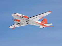
 Basler BT-67 4 Campaigns · 13 Instruments |  Oceans Melting Greenland 2015—2021 Greenland 14 Deployments · 11 Data Products
|
Filter data products from this instrument by specific campaigns, platforms, or formats.