Instrument
AirMOSS
Airborne Microwave Observatory of Subcanopy and Subsurface P-band Radar
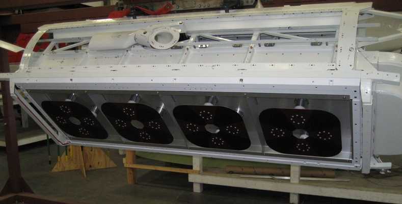
The AirMOSS P-band Radar is an airborne synthetic aperture radar (SAR) developed by the Jet Propulsion Laboratory (JPL). It is based on the Uninhabited Aerial Vehicle Synthetic Aperture Radar (UAVSAR) L-band radar and has been part of the UAVSAR instrument suite since the AirMOSS investigation concluded in 2015. AirMOSS collects radar data to measure root-zone soil moisture, permafrost, underground structures, and subsurface changes. It operates in the 280-440 MHz frequency range and can detect features up to 1.2 m below the land surface. AirMOSS has a slant-range resolution of 7 m and a range swath width of 7 km at a nominal altitude of 12,500 m.


Instrument Details
- Radar
- Earth Science > Land Surface > Soils > Soil Moisture/water ContentEarth Science > Agriculture > Soils > Soil Moisture/water ContentEarth Science > Agriculture > SoilsEarth Science > Spectral/engineering > Radar > Sigma NaughtEarth Science > Land Surface > Soils > Soil Moisture/water Content > Root Zone Soil MoistureEarth Science > Spectral/engineering > Radar > Radar ImageryEarth Science > Land Surface > Soils > PermafrostEarth Science > Biosphere > Vegetation > Forest Composition/vegetation StructureEarth Science > Land Surface > SoilsEarth Science > Agriculture > Soils > Permafrost
- Subsurface - Land, Land Surface
- N/A
- 7 m
- 280-440 MHz
- Currently unavailable
Yunling Lou
Yunling Lou
JPL
NASA
Currently unavailable
- Oak Ridge National Laboratory DAAC (ORNL)
other NASA repository not formally considered a DAAC by ESDS
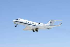
 Gulfstream III 19 Campaigns · 14 Instruments |  Airborne Microwave Observatory of Subcanopy and Subsurface 2012—2015 North America 40 Deployments · 18 Data Products
 Arctic-Boreal Vulnerability Experiment 2017—2026 Alaska, Northwestern Canada Ongoing 6 Deployments · 130 Data Products
|
Filter data products from this instrument by specific campaigns, platforms, or formats.