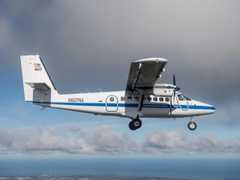
The Compact Airborne System for Imaging the Environment (CASIE) is an airborne suite of remote imaging sensors operated by the University of Washington Applied Physics Laboratory (APL). It includes three thermal infrared (TIR) cameras, a longwave radiometer, and a visible band camera that capture infrared and visible imagery and provide radiometric measurements for mapping snow, land, and tree surface temperature brightness. The TIR cameras operate in the 8-14 μm spectral range, capturing imagery at 5 Hz with a spatial resolution of 1 to 2 meters. The longwave radiometer operates in the 9.6-11.5 μm spectral region, measuring brightness temperature at 30 Hz with a spatial resolution of 50 meters. The visible band camera records imagery in the 400-700 nm range at 2 Hz with a spatial resolution of 5 meters.

Instrument Details
- Spectrometer/Radiometer
- Earth Science > Spectral/engineering > Visible Wavelengths > Visible ImageryEarth Science > Spectral/engineering > Infrared Wavelengths > Brightness TemperatureEarth Science > Spectral/engineering > Infrared Wavelengths > Thermal InfraredEarth Science > Spectral/engineering > Infrared Wavelengths > Infrared Imagery
- Land Surface
- 30 Hz, 5 Hz, 2 Hz
- 1-2 m, 35 m
- 21.4-37.5 THz, 26.1-31.2 THz, 428.3-749.5 THz
- Currently unavailable
Chris Chickadel, Jessica Lundquist
Chris Chickadel, Jessica Lundquist
Currently unavailable
Currently unavailable
Currently unavailable
Unpublished
 DeHavilland DHC-6-300 Twin Otter 23 Campaigns · 85 Instruments |  SnowEx 2016—2023 Colorado, Idaho, Utah, Alaska 4 Deployments · 86 Data Products
|
Filter data products from this instrument by specific campaigns, platforms, or formats.