The Cloud Radar System (CRS) is an airborne W-band (94 GHz) polarimetric Doppler radar designed for the NASA ER-2 aircraft. CRS provides radar observations of clouds and precipitation from the surface through the lower stratosphere. It has a horizontal resolution of 150 m and a horizontal sampling interval of 50 m. Its vertical resolution is 100 m, with a vertical sampling interval of 37.5 m.
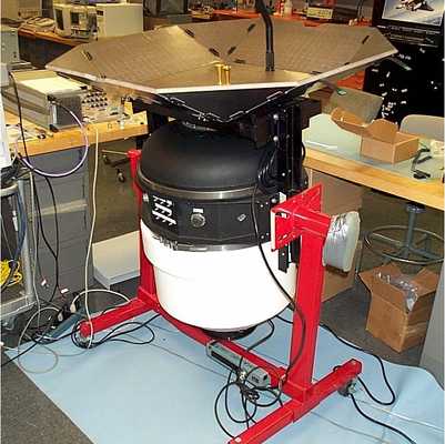

Instrument Details
- Radar
- Earth Science > Atmosphere > Clouds > Cloud MicrophysicsEarth Science > Spectral/engineering > Radar > Doppler VelocityEarth Science > Spectral/engineering > Radar > Radar ReflectivityEarth Science > Atmosphere > Clouds > Cloud PropertiesEarth Science > Atmosphere > CloudsEarth Science > Atmosphere > PrecipitationEarth Science > Atmosphere > Clouds > Tropospheric/high-level Clouds (observed/analyzed) > Cirrus/systems > Cirrus Cloud Systems
- Troposphere
- Variable
- 150 m (horizontal), 100 m (vertical)
- 94 GHz
- https://doi.org/10.1175/1520-0426(2004)021%3C1378:AGCRSO%3E2.0.CO;2
Gerald Heymsfield
Gerald Heymsfield
Goddard Mesoscale Atmospheric Processes Branch, Microwave Sensors Branch, Microwave Instrument Technology Branch, National Center for Atmospheric Research, Former Pulse Technology
NASA Atmospheric Radiation Program
Filter data products from this instrument by specific campaigns, platforms, or formats.
CAMPAIGNS
PLATFORMS
FORMATS


