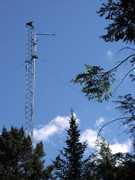
The Colorado State University Pawnee (CSU-PAWNEE) Doppler Radar was an S-band, ground-based radar located in the Pawnee National Grasslands. It was operated by CSU and often used in conjunction with the CSU-CHILL radar because of their proximity. CSU-PAWNEE operated at 2.730 GHz and had a typical range resolution of 30 meters. It was decommissioned in March 2015.

Instrument Details
- Radar
- Earth Science > Spectral/engineering > Radar > Doppler VelocityEarth Science > Spectral/engineering > Radar > Radar ReflectivityEarth Science > Spectral/engineering > Radar > Radial Velocity > Mean Radial VelocityEarth Science > Spectral/engineering > Radar > Radar ImageryEarth Science > Spectral/engineering > Radar > Radial VelocityEarth Science > Spectral/engineering > Radar > Return PowerEarth Science > Spectral/engineering > Radar > Spectrum Width
- Full Column Profile
- Variable
- 30 m
- 2.730 GHz
- Currently unavailable
Pat Kennedy, Steven Rutledge
Pat Kennedy, Steven Rutledge
Colorado State University
NSF
Currently unavailable
data center outside NASA
 Permanent Land Site Stationary 63 Campaigns · 100 Instruments |  Deep Convective Clouds & Chemistry 2012 Northeastern Colorado, West Texas to Central Oklahoma, Northern Alabama 1 Deployment · 19 Data Products
 Mid-latitude Continental Convective Clouds Experiment 2011 Central Oklahoma, Southern Plains 1 Deployment · 34 Data Products
|
Filter data products from this instrument by specific campaigns, platforms, or formats.
CAMPAIGNS
PLATFORMS