Arrow leftBack to Explore

Instrument

Ceilometer
Ceilometer

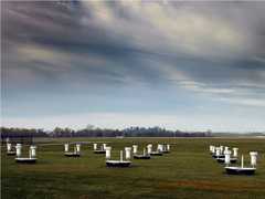
Ceilometers are ground-based remote sensing sensors that measure cloud ceilings and vertical visibility. They utilize a laser or another light source to detect backscatter from clouds, precipitation, and aerosols. Ceilometers provide detailed and precise measurements under all weather conditions and are cost-effective to operate. They are commonly used in boundary layer and cloud research.

NASA's DC-8 flying laboratory passes Antarctica's tallest peak, Mount Vinson, on Oct. 22, 2012, during a flight over the continent to measure changes in the massive ice sheet and sea ice. Credit: NASA/Michael Studinger (Photography courtesy NASA Images)

Instrument Details

Optical/Photon
Earth Science > Atmosphere > Clouds > Cloud Properties > Cloud Base Height
Earth Science > Atmosphere > Air Quality > Visibility
Earth Science > Atmosphere > Clouds > Cloud Properties > Cloud Ceiling
Earth Science > Atmosphere > Aerosols > Aerosol Backscatter
Earth Science > Atmosphere > Clouds > Cloud Properties
Earth Science > Atmosphere > Clouds
Earth Science > Atmosphere > Aerosols
Earth Science > Atmosphere > Altitude > Planetary Boundary Layer Height
Earth Science > Spectral/engineering > Lidar > Lidar Backscatter
Boundary Layer, Troposphere
Variable
Variable
Variable
https://www.arm.gov/publications/tech_reports/handbooks/ceil_handbook.pdfExternal Link
LMOS

Lake Michigan Ozone Study

2017
Lake Michigan
view all deployment dates
1 Deployment
· 14 Data Products
C3VP

Canadian CloudSat/CALIPSO Validation Project

2006—2007
Ontario, Canada
view all deployment dates
1 Deployment
· 6 Data Products
MOOSE

Michigan-Ontario Ozone Source Experiment

2021
Southern Ontario, Southeastern Michigan
view all deployment dates
1 Deployment
· 2 Data Products
ASTEX

Atlantic Stratocumulus Transition Experiment

1992
Azores and Madeira islands
view all deployment dates
1 Deployment
· 0 Data Products
MILAGRO

Megacity Initiative: Local and Global Research Observations

2006
Mexico City Metropolitan Area
view all deployment dates
1 Deployment
· 0 Data Products
R/V Glorita

R/V Glorita

1 Campaign · 7 Instruments
MAST

Monterey Area Ship Track

1994
Central California Coast, Pacific Ocean
view all deployment dates
1 Deployment
· 0 Data Products
RV 5503

NOAA RV 5503

1 Campaign · 3 Instruments
LMOS

Lake Michigan Ozone Study

2017
Lake Michigan
view all deployment dates
1 Deployment
· 14 Data Products
Valdivia

R/V Valdivia

2 Campaigns · 2 Instruments
ASTEX

Atlantic Stratocumulus Transition Experiment

1992
Azores and Madeira islands
view all deployment dates
1 Deployment
· 0 Data Products
Malcolm Baldrige

R/V Malcolm Baldrige

2 Campaigns · 9 Instruments
ASTEX

Atlantic Stratocumulus Transition Experiment

1992
Azores and Madeira islands
view all deployment dates
1 Deployment
· 0 Data Products
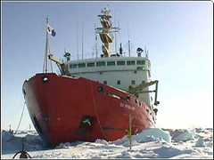
Des Groseilliers

CCGS Des Groseilliers

1 Campaign · 11 Instruments

Filter data products from this instrument by specific campaigns, platforms, or formats.

Campaigns
CAMPAIGNS
Platforms
PLATFORMS
Formats
FORMATS
10.5067/ASDC_DAAC/FIRE/0045External Link
http://dx.doi.org/10.5067/GPMGV/GCPEX/CEILOMETERS/DATA201External Link
10.5067/ASDC_DAAC/FIRE/0019External Link
10.5067/ASDC_DAAC/FIRE/0047External Link
10.5067/ASDC_DAAC/FIRE/0123External Link
10.3334/ORNLDAAC/407External Link
10.3334/ORNLDAAC/453External Link
10.3334/ORNLDAAC/408External Link
10.5067/ASDC_DAAC/FIRE/0043External Link
10.5067/ASDC_DAAC/FIRE/0044External Link