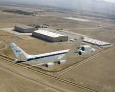
The GPS Bistatic Radar Delay Mapping Receiver (DMR) is an airborne bistatic radar receiver developed at NASA Langley Research Center (LaRC). It measures the direct, line-of-sight, right-hand circularly polarized (RHCP) signal and the delayed, earth-reflected, near-specular, left-hand circularly polarized (LHCP) signal from a GPS satellite. These measurements can determine surface properties such as soil moisture, ocean surface winds, and sea roughness. DMR operates at the L-band frequencies of 1.57542 GHz and 1.2276 GHz.

Instrument Details
- Radar
- Earth Science > Agriculture > Soils > Soil Moisture/water ContentEarth Science > Land Surface > Soils > Soil Moisture/water ContentEarth Science > Oceans > Sea Ice > Ice RoughnessEarth Science > Oceans > Ocean Winds > Surface WindsEarth Science > Oceans > Ocean WindsEarth Science > Land Surface > Soils > Soil Moisture/water Content > Surface Soil MoistureEarth Science > Land Surface > Topography > Surface Roughness
- Land Surface
- N/A
- Variable
- 1.57542 GHz, 1.2276 GHz
- Currently unavailable
Currently unavailable
Currently unavailable
LaRC
Currently unavailable
Currently unavailable
Unpublished
 Douglas DC-8 45 Campaigns · 182 Instruments | CLPX Cold Land Processes Experiment 2002—2008 Central Rocky Mountains, Colorado, Alaska 2 Deployments · 0 Data Products
| ||||||
 P-3 Orion 30 Campaigns · 153 Instruments | CLPX Cold Land Processes Experiment 2002—2008 Central Rocky Mountains, Colorado, Alaska 2 Deployments · 0 Data Products
|