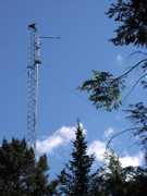
The Esrange MST Radar (ESRAD) is a ground-based mesosphere-stratosphere-troposphere (MST) radar located at Esrange, Sweden. It was designed to provide detailed information on atmospheric winds and turbulence from the troposphere to the mesosphere. ESRAD measures radar backscatter at 52 MHz, which can be used to retrieve profiles of turbulence, vertical wind, and wind speed and direction. ESRAD samples heights from 100 m to 128 km and has a range resolution of 75 m to 3 km. A typical cycle takes about 1 to 2 minutes per scanning mode.

Instrument Details
- Radar
- Earth Science > Spectral/engineering > Radar > Radar BackscatterEarth Science > Atmosphere > Atmospheric Winds > Wind ProfilesEarth Science > Atmosphere > Atmospheric Winds > Wind Profiles > Wind Velocity/speed ProfilesEarth Science > Atmosphere > Atmospheric Winds > Wind Profiles > Wind Direction ProfilesEarth Science > Atmosphere > Atmospheric Winds > Wind Dynamics > Vertical Wind Velocity/speedEarth Science > Spectral/engineering > RadarEarth Science > Atmosphere > Atmospheric Winds > Wind Dynamics > Turbulence
- Full Column Profile
- 1-2 min
- 75m-3km
- 52 MHz
- Currently unavailable
Sheila Kirkwood
Sheila Kirkwood
Swedish Institute of Space Physics
Swedish Space Corporation, Swedish Natural Science Research Council
data center outside NASA
 Permanent Land Site Stationary 63 Campaigns · 100 Instruments |  SAGE III Ozone Loss and Validation Experiment 1999—2003 Arctic, Kiruna, Sweden 2 Deployments · 32 Data Products
|