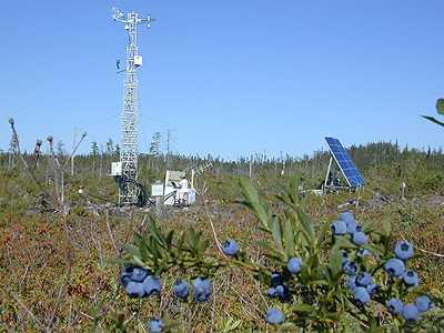
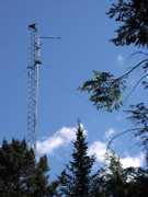
FLUXNET is a global network of eddy covariance flux towers. Each tower is equipped with gas sensors that continuously measure the fluxes of trace gases, including carbon dioxide, methane, and water vapor, between the land surface and the atmosphere. These towers also include meteorological sensors that measure air temperature, precipitation, wind, radiation, and soil temperature. FLUXNET currently has over 250 flux tower sites worldwide across vegetation types such as tundra, tropical, forest, and grasslands.


Instrument Details
- Multi
- Earth Science > Atmosphere > Atmospheric Chemistry > Carbon And Hydrocarbon Compounds > Carbon DioxideEarth Science > Atmosphere > Atmospheric Chemistry > Carbon And Hydrocarbon Compounds > MethaneEarth Science > Atmosphere > Atmospheric Chemistry > Trace Gases/trace SpeciesEarth Science > Atmosphere > Atmospheric ChemistryEarth Science > Atmosphere > Atmospheric Radiation > Longwave RadiationEarth Science > Atmosphere > Atmospheric Radiation > Shortwave RadiationEarth Science > Atmosphere > Atmospheric RadiationEarth Science > Atmosphere > Atmospheric Temperature > Surface Temperature > Air TemperatureEarth Science > Atmosphere > Atmospheric Temperature > Surface TemperatureEarth Science > Atmosphere > Atmospheric TemperatureEarth Science > Atmosphere > Atmospheric Water Vapor > Water Vapor Indicators > Humidity > Relative HumidityEarth Science > Atmosphere > Atmospheric Water VaporEarth Science > Atmosphere > Atmospheric Winds > Surface Winds > Wind DirectionEarth Science > Atmosphere > Atmospheric Winds > Surface Winds > Wind SpeedEarth Science > Atmosphere > Atmospheric Winds > Surface WindsEarth Science > Atmosphere > Atmospheric WindsEarth Science > Atmosphere > PrecipitationEarth Science > Land Surface > Soils > Soil Moisture/water ContentEarth Science > Land Surface > Soils > Soil Temperature
- Boundary Layer, Land Surface
- Variable
- Point
- Variable
- Currently unavailable
Currently unavailable
Currently unavailable
Currently unavailable
NASA
 Permanent Land Site Stationary 63 Campaigns · 100 Instruments |  Airborne Microwave Observatory of Subcanopy and Subsurface 2012—2015 North America 40 Deployments · 18 Data Products
 Arctic-Boreal Vulnerability Experiment 2017—2026 Alaska, Northwestern Canada Ongoing 6 Deployments · 130 Data Products
 NASA African Monsoon Multidisciplinary Analyses 2006 Cape Verde Islands, Atlantic Ocean 1 Deployment · 22 Data Products
 BigFoot Project 1999—2004 United States, Canada, Brazil 16 Deployments · 6 Data Products
|
Filter data products from this instrument by specific campaigns, platforms, or formats.