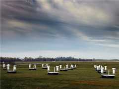
Ground-penetrating radar (GPR) is an electromagnetic geophysical technique used to image the subsurface. It transmits radio-wave pulses and detects returning signals to determine the depth and size of subsurface targets. GPR typically operates in the 10 to 1000 MHz frequency range and can reach depths of about 10 to 100 meters, depending on the surface. In Earth science, GPR is used to measure ice thickness, soil layers, groundwater levels, bedrock depth, water depth, rock fractures, and other applications.

Instrument Details
- Radar
- Earth Science > Spectral/engineering > Radar > Radar ReflectivityEarth Science > Spectral/engineering > RadarEarth Science > Spectral/engineering > Radar > Radar Imagery
- Subsurface - Land
- Variable
- Variable
- 10-1000 MHz
- Currently unavailable
Currently unavailable
Currently Unavailable
Varies
Currently unavailable
Currently unavailable
 Field Site Stationary 76 Campaigns · 175 Instruments |  SnowEx 2016—2023 Colorado, Idaho, Utah, Alaska 4 Deployments · 86 Data Products
|
Filter data products from this instrument by specific campaigns, platforms, or formats.
CAMPAIGNS
PLATFORMS
FORMATS