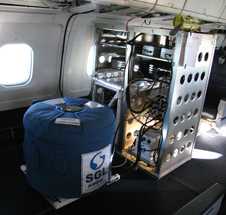
Gravimeters are passive sensors that measure the strength of Earth’s gravitational field. These measurements are used to determine rock density variations, support oil and mineral prospecting, monitor glacier changes, and study volcanic activity. Gravimeters can be used for both airborne and ground-based operations.


Instrument Details
- Magnetic/Electric
- Earth Science > Solid Earth > Gravity/gravitational FieldEarth Science > Solid Earth > Gravity/gravitational Field > Gravitational FieldEarth Science > Solid Earth > Gravity/gravitational Field > Gravity
- Land Surface
- Variable
- Variable
- Variable
- Currently unavailable
Currently unavailable
Currently unavailable
Varies
Currently unavailable
Currently unavailable
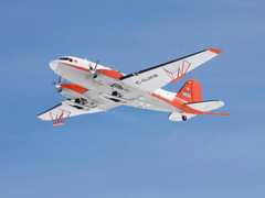
 Basler BT-67 4 Campaigns · 13 Instruments |  Operation IceBridge 2009—2021 Greenland, Antarctica, Alaska, Arctic Sea 37 Deployments · 79 Data Products
| ||||||||||||||||||||||||||||||||||||||||||||||||||||||||||||||||||||||||||||
 P-3 Orion 30 Campaigns · 153 Instruments |  Operation IceBridge 2009—2021 Greenland, Antarctica, Alaska, Arctic Sea 37 Deployments · 79 Data Products
| ||||||||||||||||||||||||||||||||||||||||||||||||||||||||||||||||||||||||||||
 Gulfstream-V 8 Campaigns · 38 Instruments |  Operation IceBridge 2009—2021 Greenland, Antarctica, Alaska, Arctic Sea 37 Deployments · 79 Data Products
| ||||||||||||||||||||||||||||||||||||||||||||||||||||||||||||||||||||||||||||
 R/V Roger Revelle 2 Campaigns · 16 Instruments |  EXport Processes in the Ocean from RemoTe Sensing 2018—2021 Northeast Pacific Ocean, Northeast Atlantic 2 Deployments · 0 Data Products
|
Filter data products from this instrument by specific campaigns, platforms, or formats.
CAMPAIGNS
PLATFORMS
FORMATS