The High Altitude Lidar Observatory (HALO) is an airborne lidar system developed by NASA's Langley Research Center. HALO operates at four wavelengths (1645, 1064, 935, and 532 nm) and combines Differential Absorption Lidar (DIAL) and High Spectral Resolution Lidar (HSRL) to measure lidar backscatter and depolarization ratio. It provides vertical profiles of aerosol and cloud optical properties, atmospheric water vapor, and methane at a data rate of 2 Hz. HALO has a nominal spatial resolution of 12 km horizontally and 315 m vertically at an altitude of 10 km.
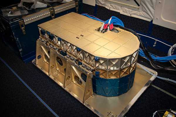

Instrument Details
- Lidar
- Earth Science > Atmosphere > Atmospheric Chemistry > Carbon And Hydrocarbon Compounds > MethaneEarth Science > Atmosphere > Aerosols > Aerosol ExtinctionEarth Science > Atmosphere > Atmospheric Water VaporEarth Science > Atmosphere > Atmospheric Water Vapor > Water Vapor ProfilesEarth Science > Atmosphere > AerosolsEarth Science > Atmosphere > Aerosols > Aerosol BackscatterEarth Science > Atmosphere > Clouds > Cloud Microphysics > Cloud Optical Depth/thicknessEarth Science > Atmosphere > Aerosols > Aerosol Optical Depth/thicknessEarth Science > Spectral/engineering > Lidar > Lidar Depolarization Ratio
- Full Column Profile
- 2 Hz
- 12 km horizontal, 315 m vertical
- 182 THz, 282 THz, 321 THz, 564 THz
- Currently unavailable
Amin Nehrir
Amin Nehrir
LaRC
NASA
Currently unavailable
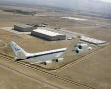 Douglas DC-8 45 Campaigns · 182 Instruments | Aeolus Cal/Val NASA Aeolus Calibration/Validation Test Flight Campaign 2019 Eastern Pacific Ocean 1 Deployment · 4 Data Products
 Convective Processes Experiment – Aerosols & Winds 2021 St. Croix, U.S. Virgin Islands; Western Atlantic and Caribbean Sea 1 Deployment · 10 Data Products
 Convective Processes EXperiment - Cabo Verde 2022 Cabo Verde, Tropical East Atlantic Ocean 1 Deployment · 10 Data Products
 Student Airborne Research Program 2009—2026 Southern California, Virginia Ongoing 19 Deployments · 25 Data Products
| ||||||||||||||||||||||||||||||||||||||||||||||||||||||||||
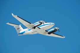 Beechcraft B-200 King Air 39 Campaigns · 84 Instruments |  Ozone Water-Land Environmental Transition Study 2017—2018 Chesapeake Bay 2 Deployments · 12 Data Products
| ||||||||||||||||||||||||||||||||||||||||||||||||||||||||||
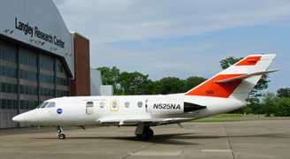 HU-25 Guardian 2 Campaigns · 8 Instruments | LISTOS Long Island Sound Tropospheric Ozone Study 2017—2019 New York City metropolitan and Long Island Sound area, Northeastern U.S. 2 Deployments · 17 Data Products
| ||||||||||||||||||||||||||||||||||||||||||||||||||||||||||
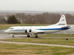 P-3 Orion 30 Campaigns · 153 Instruments |  Investigation of Microphysics and Precipitation for Atlantic Coast-Threatening Snowstorms 2020—2023 Eastern United States 3 Deployments · 73 Data Products
| ||||||||||||||||||||||||||||||||||||||||||||||||||||||||||
 C-130 Hercules 17 Campaigns · 96 Instruments |  Atmospheric Carbon and Transport – America 2016—2019 Midwest, Mid-Atlantic, Southern US 5 Deployments · 17 Data Products
| ||||||||||||||||||||||||||||||||||||||||||||||||||||||||||
 Gulfstream III 19 Campaigns · 14 Instruments |  Synergistic TEMPO Air Quality Science 2023 Los Angeles, New York City, Chicago, United States, North America 1 Deployment · 11 Data Products
 Westcoast & Heartland Hyperspectral Microwave Sensor Intensive Experiment 2024 Western United States, Great Plains, Pacific Ocean 1 Deployment · 0 Data Products
 Arctic Radiation-Cloud-Aerosol-Surface Interaction EXperiment 2024 Greenland, Arctic Ocean 2 Deployments · 13 Data Products
 Student Airborne Research Program 2009—2026 Southern California, Virginia Ongoing 19 Deployments · 25 Data Products
 Appalachian Active Passive Methane Airborne Constraints 2025 Appalachian Basin, Washington D.C., Baltimore 1 Deployment · 0 Data Products
|
Filter data products from this instrument by specific campaigns, platforms, or formats.