The Hurricane Imaging Radiometer (HIRAD) is an airborne, single-polarization, passive C-band radiometer. It measures brightness temperature to determine rain rate and wind speed. HIRAD operates at four frequencies (4, 5, 6, and 6.6 GHz) and typically has a spatial resolution of 1-3 km. Its design is based on the Stepped Frequency Microwave Radiometer (SFMR) and includes wide-swath measurement capabilities.


Instrument Details
- Spectrometer/Radiometer
- Earth Science > Atmosphere > Precipitation > Precipitation RateEarth Science > Atmosphere > PrecipitationEarth Science > Oceans > Ocean Winds > Surface WindsEarth Science > Spectral/engineering > Microwave > Brightness TemperatureEarth Science > Atmosphere > Atmospheric Winds > Surface Winds > Wind DirectionEarth Science > Atmosphere > Atmospheric Winds > Surface Winds > Wind SpeedEarth Science > Atmosphere > Atmospheric WindsEarth Science > Oceans > Ocean Winds
- Column Integrated
- N/A
- 1-3 km
- 4, 5, 6, 6.6 GHz
- https://doi.org/10.1175/JTECH-D-17-0031.1
Dan Cecil
Dan Cecil
NASA MSFC
NASA
Currently unavailable
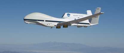
 Global Hawk 5 Campaigns · 30 Instruments |  Hurricane and Severe Storm Sentinel 2012—2014 Subtropical Atlantic Ocean and Gulf of Mexico 3 Deployments · 15 Data Products
| ||||||||||||
 NASA WB-57 17 Campaigns · 84 Instruments |  Hurricane and Severe Storm Sentinel 2012—2014 Subtropical Atlantic Ocean and Gulf of Mexico 3 Deployments · 15 Data Products
 Genesis and Rapid Intensification Processes 2010 Tropical Atlantic, Gulf of Mexico, Eastern North Pacific, Caribbean Sea 1 Deployment · 24 Data Products
|
Filter data products from this instrument by specific campaigns, platforms, or formats.
CAMPAIGNS
PLATFORMS
FORMATS