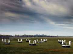
The Halo Doppler Lidar is a ground-based Doppler wind lidar developed by Halo Photonics. It measures 1.5-micron lidar backscatter to retrieve boundary layer wind profiles. It can also determine aerosol loading and turbulence. It has a maximum range of 10 km and a vertical resolution of 18 to 60 m, depending on profiling needs. Halo Doppler Lidar has a pulse rate of 10 kHz and a sampling rate of 1 Hz.

Instrument Details
- Lidar
- Earth Science > Atmosphere > Atmospheric Winds > Upper Level Winds > Boundary Layer WindsEarth Science > Atmosphere > Atmospheric Winds > Wind ProfilesEarth Science > Spectral/engineering > Lidar > Lidar BackscatterEarth Science > Spectral/engineering > LidarEarth Science > Atmosphere > Atmospheric Winds > Wind Profiles > Wind Velocity/speed ProfilesEarth Science > Atmosphere > Atmospheric Winds > Wind Profiles > Wind Direction ProfilesEarth Science > Atmosphere > AerosolsEarth Science > Atmosphere > Atmospheric Winds > Wind Dynamics > Turbulence
- Full Column Profile
- 1 Hz
- 18-60 m
- 200 THz
- Currently unavailable
Tim Wagner
Tim Wagner
Currently unavailable
Currently unavailable
Currently unavailable
Unpublished
 Field Site Stationary 76 Campaigns · 175 Instruments |  Synergistic TEMPO Air Quality Science 2023 Los Angeles, New York City, Chicago, United States, North America 1 Deployment · 11 Data Products
 Investigation of Microphysics and Precipitation for Atlantic Coast-Threatening Snowstorms 2020—2023 Eastern United States 3 Deployments · 73 Data Products
| ||||||||||||
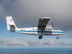
 DeHavilland DHC-6-300 Twin Otter 23 Campaigns · 85 Instruments | CalNex California Research at the Nexus of Air Quality and Climate Change 2010 California 1 Deployment · 0 Data Products
|
Filter data products from this instrument by specific campaigns, platforms, or formats.