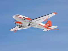
The High Capability Airborne Radar Sounder (HiCARS) is an airborne ice-penetrating radar operated by the University of Texas Institute of Geophysics (UTIG). It is a very high-frequency (VHF) radar that records phase-coherent radar returns to produce profiles of ice sheets, identifying the ice surface, internal layers, and bedrock. It has twin flat dipole antennas mounted under each aircraft wing, 19 meters apart horizontally, providing about 10 dB of antenna gain. HiCARS operates in the 52.5 to 67.5 MHz frequency range and has a sampling rate of 50 MHz.

Instrument Details
- Radar
- Earth Science > Cryosphere > Snow/ice > Ice Depth/thicknessEarth Science > Land Surface > Topography > Terrain ElevationEarth Science > Climate Indicators > Cryospheric Indicators > Ice Depth/thicknessEarth Science > Cryosphere > Sea Ice > Ice Depth/thicknessEarth Science > Land Surface > Topography > Terrain Elevation > Bed ElevationEarth Science > Spectral/engineering > Radar > Return PowerEarth Science > Spectral/engineering > Radar
- Subsurface - Land, Land Surface
- 50 MHz
- Variable
- 52.5-67.5 MHz
- Currently unavailable
Currently unavailable
Currently unavailable
UTIG
Currently unavailable
Currently unavailable
 Basler BT-67 4 Campaigns · 13 Instruments |  Operation IceBridge 2009—2021 Greenland, Antarctica, Alaska, Arctic Sea 37 Deployments · 79 Data Products
|
Filter data products from this instrument by specific campaigns, platforms, or formats.