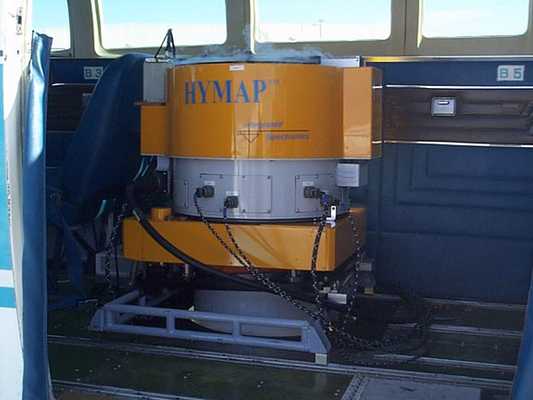
The HyMap Hyperspectral Scanner is a commercial airborne imaging spectrometer developed by Integrated Spectronics Inc. in Sydney, Australia. It uses a whiskbroom scanner to capture hyperspectral imagery across 128 bands in the reflective solar wavelength range (0.45-2.5 μm). It provides a spatial resolution of 2 to 10 meters, a swath width of 60 to 70 degrees, and a signal-to-noise ratio exceeding 500:1. HyMap has been used to map vegetation, soils, agriculture, and minerals.


Instrument Details
- Spectrometer/Radiometer
- Earth Science > Spectral/engineering > Visible Wavelengths > Visible RadianceEarth Science > Spectral/engineering > Visible Wavelengths > Visible ImageryEarth Science > Spectral/engineering > Infrared Wavelengths > Infrared RadianceEarth Science > Spectral/engineering > Infrared Wavelengths > Infrared Imagery
- Land Surface
- N/A
- 2-10 m
- 119.9-666.2 THz
- https://artefacts.ceda.ac.uk/neodc_docs/Hymap_specs.pdf
Terry Cocks
Terry Cocks
Integrated Spectronics
Currently unavailable
Currently unavailable
Unpublished
 NASA WB-57 17 Campaigns · 84 Instruments |  Costa Rica Airborne Research and Technology Applications 2005 2005 San Jose, Costa Rica 1 Deployment · 0 Data Products
|