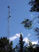
The Lightning Detection and Ranging (LDAR) system is a ground-based lightning network at Kennedy Space Center (KSC). It comprises seven very high-frequency (VHF) radio receivers that detect radio pulses from lightning. These receivers are arranged in a hexagonal pattern, 6 to 10 km from the central receiver. The LDAR system operates at 66 MHz with a bandwidth of 6 MHz. It has a typical detection range of 100 km and a time resolution of 10 ns. It provides near real-time lightning mapping to support Space Shuttle operations.

Instrument Details
- Magnetic/Electric
- Earth Science > Atmosphere > Atmospheric Electricity > Electric FieldEarth Science > Atmosphere > Atmospheric ElectricityEarth Science > Atmosphere > Atmospheric Electricity > LightningEarth Science > Atmosphere > Weather Events > Lightning
- Troposphere
- 10 ns
- N/A
- 66 MHz
- https://ntrs.nasa.gov/citations/19790025501
Richard Blakeslee
Richard Blakeslee
Global Atmospherics, Inc, KSC
NASA
Currently unavailable
 Permanent Land Site Stationary 63 Campaigns · 100 Instruments |  Altus Cumulus Electrification Study 2002 Florida Everglades 1 Deployment · 6 Data Products
CaPE Convection and Precipitation/Electrification Experiment 1991 East-Central Florida 1 Deployment · 0 Data Products
|