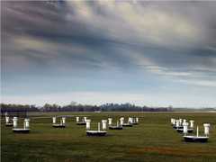
The Leica ScanStation C10 is a ground-based high-definition surveying (HDS) scanner manufactured by Leica Geosystems. It provides terrestrial lidar scanning (TLS) point cloud measurements to determine canopy structure and surface topography. It operates at a wavelength of 532 nm and has a scan rate of up to 50,000 points per second. Its range resolution is 130 to 300 m, depending on the surface albedo.

Instrument Details
- Lidar
- Earth Science > Land Surface > Topography > Terrain ElevationEarth Science > Land Surface > TopographyEarth Science > Land Surface > Topography > Terrain Elevation > Topographical Relief MapsEarth Science > Spectral/engineering > Lidar > Lidar BackscatterEarth Science > Spectral/engineering > Lidar
- Land Surface
- 50,000 Hz
- 130-300 m
- 564 THz
- https://doi.org/10.1007/978-3-642-36379-5_3
Currently unavailable
Currently unavailable
Leica Geosystems
NASA
Currently unavailable
 Field Site Stationary 76 Campaigns · 175 Instruments |  SnowEx 2016—2023 Colorado, Idaho, Utah, Alaska 4 Deployments · 86 Data Products
|