The MODIS/ASTER Airborne Simulator (MASTER) is an airborne scanning spectrometer developed at NASA Ames Research Center (ARC) in collaboration with the Jet Propulsion Laboratory (JPL) to support the validation of MODIS and ASTER retrieval algorithms. MASTER is maintained and operated by the Airborne Sensor Facility (ASF) at ARC. It provides visible-to-shortwave infrared and thermal infrared imagery and operates across 50 spectral channels spanning 0.4-13 μm. MASTER features a spatial resolution of 5 to 50 meters and a swath width of 1.87 to 37.25 km, depending on flight altitude. Its typical scan rate is 6.25 Hz.
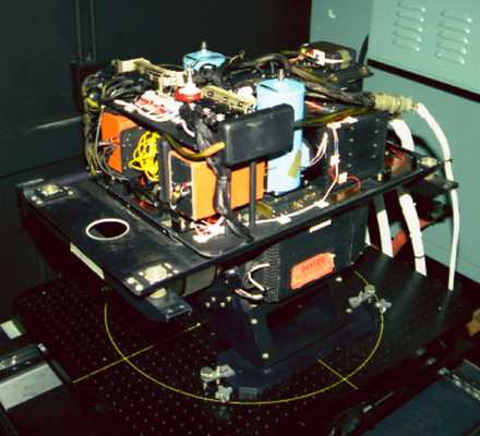

Instrument Details
- Spectrometer/Radiometer
- Earth Science > Land Surface > Surface Thermal PropertiesEarth Science > Spectral/engineering > Infrared Wavelengths > Thermal InfraredEarth Science > Spectral/engineering > Visible Wavelengths > Visible RadianceEarth Science > Land Surface > Surface Thermal Properties > Land Surface TemperatureEarth Science > Land Surface > Surface Radiative Properties > EmissivityEarth Science > Land Surface > Surface Radiative PropertiesEarth Science > Spectral/engineering > Infrared Wavelengths > Infrared Radiance
- Land Surface, Troposphere
- 6.25 Hz, 12.5 Hz, 25 Hz
- 5-50 m
- 23-750 THz
- https://doi.org/10.1117/12.258115
Simon Hook
James Jacobson
ARC, JPL
NASA
 NASA Earth Resources-2 Aircraft 63 Campaigns · 109 Instruments |  Student Airborne Research Program 2009—2026 Southern California, Virginia Ongoing 19 Deployments · 25 Data Products
 Tropical Composition, Cloud and Climate Coupling 2007 Costa Rica, tropical Eastern Pacific 1 Deployment · 2 Data Products
HyspIRI Airborne Hyperspectral Infrared Imager Preparatory Airborne Campaign 2013—2018 Southern California, Western Nevada, Hawaii 15 Deployments · 16 Data Products
WDTS Western Diversity Time Series 2020—2026 Southern California, Nevada, Pacific Ocean Ongoing 6 Deployments · 6 Data Products
 Geological Earth Mapping Experiment 2023—2026 Southwestern United States, California, Arizona, Nevada, New Mexico Ongoing 4 Deployments · 2 Data Products
 Westcoast & Heartland Hyperspectral Microwave Sensor Intensive Experiment 2024 Western United States, Great Plains, Pacific Ocean 1 Deployment · 0 Data Products
 Geoscience Laser Altimeter System Validation Experiment 2003 Western United States, Pacific Ocean 1 Deployment · 0 Data Products
| ||||||||||||||||||||||||||||||||||||||||||||||||||||||||||||||||||||||||||||||||||||||||||||||||||||||||||||
 Douglas DC-8 45 Campaigns · 182 Instruments |  Fire Influence on Regional to Global Environments and Air Quality 2019 Northwestern and Southeastern US 1 Deployment · 27 Data Products
 Student Airborne Research Program 2009—2026 Southern California, Virginia Ongoing 19 Deployments · 25 Data Products
PacRim II Pacific Rim 2000 2000 South Pacific Region, United States 1 Deployment · 0 Data Products
| ||||||||||||||||||||||||||||||||||||||||||||||||||||||||||||||||||||||||||||||||||||||||||||||||||||||||||||
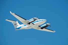 Beechcraft B-200 King Air 39 Campaigns · 84 Instruments |  FireSense 2023—2027 Western United States, Southeastern United States, California, Montana, Arizona, Utah, Colorado, Alabama, Florida, Georgia, Mississippi, Texas, Oklahoma Ongoing 3 Deployments · 1 Data Product
| ||||||||||||||||||||||||||||||||||||||||||||||||||||||||||||||||||||||||||||||||||||||||||||||||||||||||||||
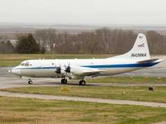 P-3 Orion 30 Campaigns · 153 Instruments |  Student Airborne Research Program 2009—2026 Southern California, Virginia Ongoing 19 Deployments · 25 Data Products
| ||||||||||||||||||||||||||||||||||||||||||||||||||||||||||||||||||||||||||||||||||||||||||||||||||||||||||||
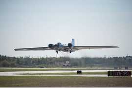 NASA WB-57 17 Campaigns · 84 Instruments |  Costa Rica Airborne Research and Technology Applications 2005 2005 San Jose, Costa Rica 1 Deployment · 0 Data Products
|
Filter data products from this instrument by specific campaigns, platforms, or formats.