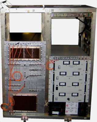
The Multichannel Coherent Radar Depth Sounder (MCoRDS) is an airborne radar developed by the Center for Remote Sensing of Ice Sheets (CReSIS) at the University of Kansas. It is a multichannel radar sounder used to measure ice sheet thickness and map subsurface ice layers to depths exceeding 4 km. It operates across the 150 to 450 MHz frequency range and has a sampling frequency of up to 1.6 GHz. MCoRDS has a vertical resolution ranging from about 60 cm to about 20 m, depending on the frequency range and flight altitude.


Instrument Details
- Radar
- Earth Science > Cryosphere > Glaciers/ice Sheets > Glacier Thickness/ice Sheet ThicknessEarth Science > Spectral/engineering > Radar > Radar ImageryEarth Science > Cryosphere > Glaciers/ice SheetsEarth Science > Terrestrial Hydrosphere > Glaciers/ice Sheets > Glacier Thickness/ice Sheet ThicknessEarth Science > Terrestrial Hydrosphere > Glaciers/ice SheetsEarth Science > Spectral/engineering > Radar
- Land Surface
- up to 1.6 GHz
- 0.6-20 m
- 150-450 MHz
- Currently unavailable
Carl Leuschen
Carl Leuschen
CReSIS
Currently unavailable
Currently unavailable
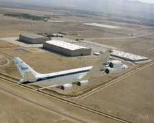
 Douglas DC-8 45 Campaigns · 182 Instruments |  Operation IceBridge 2009—2021 Greenland, Antarctica, Alaska, Arctic Sea 37 Deployments · 79 Data Products
| ||||||||||||||||||||||||||||||||||||||||||||||||||||||||||||||||||||||||||||
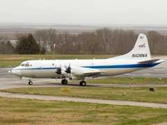
 P-3 Orion 30 Campaigns · 153 Instruments |  Operation IceBridge 2009—2021 Greenland, Antarctica, Alaska, Arctic Sea 37 Deployments · 79 Data Products
| ||||||||||||||||||||||||||||||||||||||||||||||||||||||||||||||||||||||||||||
 C-130 Hercules 17 Campaigns · 96 Instruments |  Operation IceBridge 2009—2021 Greenland, Antarctica, Alaska, Arctic Sea 37 Deployments · 79 Data Products
| ||||||||||||||||||||||||||||||||||||||||||||||||||||||||||||||||||||||||||||
 Gulfstream-V 8 Campaigns · 38 Instruments |  Operation IceBridge 2009—2021 Greenland, Antarctica, Alaska, Arctic Sea 37 Deployments · 79 Data Products
| ||||||||||||||||||||||||||||||||||||||||||||||||||||||||||||||||||||||||||||
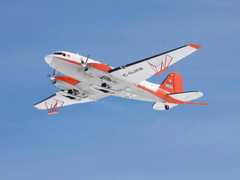
 Basler BT-67 4 Campaigns · 13 Instruments |  Operation IceBridge 2009—2021 Greenland, Antarctica, Alaska, Arctic Sea 37 Deployments · 79 Data Products
|
Filter data products from this instrument by specific campaigns, platforms, or formats.