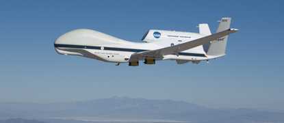
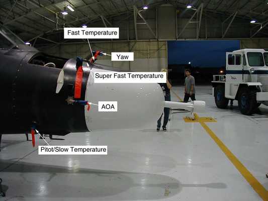
The Meteorological Measurement System (MMS) is an in situ airborne instrument that measures atmospheric state parameters. MMS provides high-resolution, accurate measurements of atmospheric pressure, temperature, and wind direction and speed immediately around the aircraft. Additional parameters that can be derived include potential temperature, true airspeed, turbulence dissipation rate, and Reynolds number. Measurements of all parameters are typically collected at a rate of 20 Hz.

Instrument Details
- Multi
- Earth Science > Atmosphere > AltitudeEarth Science > Atmosphere > Atmospheric Pressure > Atmospheric Pressure MeasurementsEarth Science > Atmosphere > Atmospheric Pressure > Static PressureEarth Science > Atmosphere > Atmospheric PressureEarth Science > Atmosphere > Atmospheric Temperature > Upper Air TemperatureEarth Science > Atmosphere > Atmospheric TemperatureEarth Science > Atmosphere > Atmospheric Winds > Upper Level Winds > Flight Level WindsEarth Science > Atmosphere > Atmospheric Winds > Upper Level Winds > U/v Wind ComponentsEarth Science > Atmosphere > Atmospheric Winds > Upper Level Winds > Wind DirectionEarth Science > Atmosphere > Atmospheric Winds > Upper Level Winds > Wind SpeedEarth Science > Atmosphere > Atmospheric Winds > Upper Level WindsEarth Science > Atmosphere > Atmospheric Winds > Wind Dynamics > TurbulenceEarth Science > Atmosphere > Atmospheric WindsEarth Science > Spectral/engineering > Platform Characteristics > Airspeed/ground Speed
- Lower Stratosphere, Troposphere
- 20 Hz
- Point
- N/A
- https://core.ac.uk/download/pdf/42817644.pdf
T. Paul Bui
T. Paul Bui
Currently unavailable
NASA Upper Atmosphere Research Program
Filter data products from this instrument by specific campaigns, platforms, or formats.
CAMPAIGNS
PLATFORMS
FORMATS
