The Measurement of Pollution in the Troposphere - Aircraft (MOPITT-A) is an airborne radiometer developed at the University of Toronto. It is a scaled-down version of the MOPITT instrument on the Terra satellite and is used for validation measurements. It detects thermal and solar radiation to provide column measurements of carbon monoxide (CO) and methane (CH4). MOPITT-A operates across four channels at wavelengths of 4.617 μm, 2.334 μm, and 2.258 μm. Its footprint is 2.52 km, with an accuracy of 10% for CO and 1% for CH4.

Instrument Details
- Spectrometer/Radiometer
- Earth Science > Atmosphere > Atmospheric Chemistry > Carbon And Hydrocarbon Compounds > Carbon MonoxideEarth Science > Atmosphere > Atmospheric Chemistry > Carbon And Hydrocarbon Compounds > MethaneEarth Science > Atmosphere > Atmospheric Radiation > Solar RadiationEarth Science > Atmosphere > Atmospheric ChemistryEarth Science > Atmosphere > Atmospheric RadiationEarth Science > Spectral/engineering > Infrared Wavelengths > Infrared RadianceEarth Science > Atmosphere > Atmospheric Radiation > Reflectance
- Column Integrated, Troposphere
- N/A
- 2.52 km
- 65 THz, 128 THz, 133 THz
- https://doi.org/10.1117/12.366405
James Drummond
James Drummond
University of Toronto
Canada Space Agency
data center outside NASA
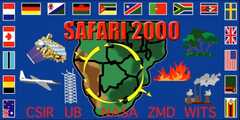
 NASA Earth Resources-2 Aircraft 63 Campaigns · 109 Instruments |  Southern African Regional Science Initiative 1999—2001 Southern Africa 4 Deployments · 110 Data Products
|