The Multiscale Observing System of the Ocean Surface (MOSES) is an airborne infrared camera system developed by the University of California, Los Angeles (UCLA) and the French Institute for Ocean Science (IFREMER). It provides longwave infrared (9-12.5 μm) imagery at a sampling rate of 2 Hz, enabling sea surface temperature determination. MOSES has a resolution of 10 m and a swath width of 5.4 km at an altitude of 28,000 ft. It has a measurement accuracy of 0.1 K.

Instrument Details
- Optical/Photon
- Earth Science > Oceans > Ocean Temperature > Sea Surface TemperatureEarth Science > Spectral/engineering > Infrared WavelengthsEarth Science > Spectral/engineering > Infrared Wavelengths > Infrared Imagery
- Sea/Ocean/Water Surface
- 2 Hz
- 10 m
- 24-33.3 THz
- Currently unavailable
Jeroen Molemaker
Jeroen Molemaker
UCLA, IFREMER
Currently unavailable
Currently unavailable
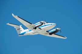
 Beechcraft B-200 King Air 39 Campaigns · 84 Instruments |  Sub-Mesoscale Ocean Dynamics Experiment 2021—2023 Centered approximately 300 km offshore of San Francisco, California, USA 3 Deployments · 39 Data Products
|
Filter data products from this instrument by specific campaigns, platforms, or formats.
CAMPAIGNS
PLATFORMS
FORMATS