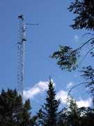
The NASA Micro-Pulse Lidar Network (MPLNET) is a worldwide ground-based network of Micro-Pulse Lidar (MPL) systems that has been operational since 1999. MPLNET provides continuous observations of aerosol and cloud vertical structures, as well as boundary layer height, from the surface up to 30 km. The MPL systems operate at wavelengths of 523-532 nm and have vertically resolved spatial resolution of 30 to 75 meters, depending on the station. Many MPLNET sites are co-located with sites in the NASA Aerosol Robotic Network (AERONET) to help minimize retrieval errors.

Instrument Details
- Lidar
- Earth Science > Atmosphere > Aerosols > Aerosol BackscatterEarth Science > Atmosphere > Aerosols > Aerosol ExtinctionEarth Science > Atmosphere > Aerosols > Aerosol Optical Depth/thicknessEarth Science > Atmosphere > Aerosols > Aerosol Particle PropertiesEarth Science > Atmosphere > AerosolsEarth Science > Atmosphere > Altitude > Planetary Boundary Layer HeightEarth Science > Atmosphere > Clouds > Cloud Microphysics > Cloud Optical Depth/thicknessEarth Science > Atmosphere > Clouds > Cloud Properties > Cloud HeightEarth Science > Atmosphere > Clouds > Cloud Properties > Cloud Vertical DistributionEarth Science > Atmosphere > Clouds > Cloud PropertiesEarth Science > Atmosphere > CloudsEarth Science > Spectral/engineering > Lidar > Lidar BackscatterEarth Science > Spectral/engineering > Lidar > Lidar Depolarization Ratio
- Full Column Profile
- 1 min
- 30-75 m
- 573 THz, 569 THz, 564 THz
- Currently unavailable
Ellsworth Judd Nelson
Sebastian A. Stewart
NASA
NASA Radiation Sciences Program
other NASA repository not formally considered a DAAC by ESDS
Filter data products from this instrument by specific campaigns, platforms, or formats.


