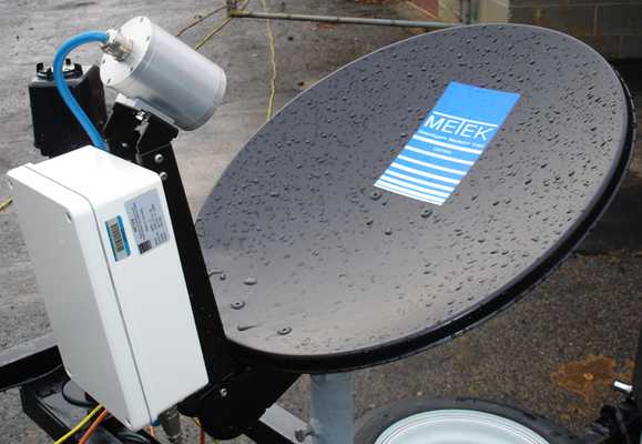
The Micro Rain Radar (MRR) is a ground-based, vertically oriented, continuous-wave K-band (24.23 GHz) radar that measures precipitation parameters, such as liquid water content and rain rate, from near ground level to the lower troposphere. The backscatter captured by the MRR’s antenna can determine precipitation size distributions ranging from 0.25 mm to 4.53 mm and can also calculate the Doppler frequency shift of falling precipitation to determine its velocity. Additional uses of the MRR include identifying bright bands, nowcasting precipitation, and tracking chemical transport during precipitation events. It has a range resolution of 10 to 200 meters and a sampling time of 10 seconds.

Instrument Details
- Radar
- Earth Science > Spectral/engineering > Radar > Radar ImageryEarth Science > Spectral/engineering > Radar > Doppler VelocityEarth Science > Spectral/engineering > Radar > Return PowerEarth Science > Spectral/engineering > Radar > Radar BackscatterEarth Science > Spectral/engineering > Radar > Radar ReflectivityEarth Science > Atmosphere > Clouds > Cloud Microphysics > Particle Size DistributionEarth Science > Atmosphere > PrecipitationEarth Science > Atmosphere > Precipitation > Precipitation Rate
- Full Column Profile
- 10 s
- 10 m - 200 m
- 24.23 GHz
- Currently unavailable
Currently unavailable
Currently unavailable
METEK, Biral
Currently unavailable
Currently unavailable
Filter data products from this instrument by specific campaigns, platforms, or formats.
