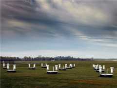
The Multiband Vegetation Image (MVI) is a ground-based imager operated by the University of Wisconsin. It combines a charge-coupled device (CCD) camera with a two-band filter exchange mechanism to capture imagery in the visible (400-620 nm) and near-infrared (720-950 nm) spectral bands. This imagery is used to determine canopy and leaf characteristics, including leaf area index (LAI), canopy gap fraction, canopy gap-size distribution, and leaf angle distribution. Each image is 512 x 1024 pixels, with each pixel representing 1 cm at a distance of 10 m from the camera. MVI has a field of view (FOV) of 15 x 30 degrees.

Instrument Details
- Optical/Photon
- Earth Science > Biosphere > Vegetation > Canopy CharacteristicsEarth Science > Spectral/engineering > Visible Wavelengths > Visible ImageryEarth Science > Biosphere > Vegetation > Leaf CharacteristicsEarth Science > Biosphere > VegetationEarth Science > Biosphere > Vegetation > Leaf Characteristics > Leaf Area Index (lai)Earth Science > Spectral/engineering > Infrared Wavelengths > Infrared Imagery
- Land Surface
- N/A
- 512 x 1024 pixels
- 483.5-749.5 THz, 315.6-416.4 THz
- https://doi.org/10.1029/97JD01175
Christopher Kucharik, John Norman
Christopher Kucharik, John Norman, Shelaine Curd
SpectraSource Instruments
Currently unavailable
 Field Site Stationary 76 Campaigns · 175 Instruments |  Boreal Ecosystem-Atmosphere Study 1994—1996 Boreal forests of central Canada 2 Deployments · 303 Data Products
|
Filter data products from this instrument by specific campaigns, platforms, or formats.