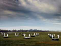
The NOAA/ETL Scanning Ka-band Cloud Radar (NOAA/K) is a ground-based millimeter-wave radar. It operates at 34.66 GHz to measure radar reflectivity and Doppler velocity. These measurements are used to characterize cloud microphysical properties, including droplet size and concentration. NOAA/K has a beam width of 0.3 to 0.5 degrees, a pulse length of 0.25 microseconds, and a resolution of 37.5 meters. It is deployed on a flatbed trailer, making it easily transportable.

Instrument Details
- Radar
- Earth Science > Atmosphere > Clouds > Cloud MicrophysicsEarth Science > Atmosphere > CloudsEarth Science > Atmosphere > Precipitation > HydrometeorsEarth Science > Spectral/engineering > Radar > Radar ImageryEarth Science > Atmosphere > PrecipitationEarth Science > Spectral/engineering > Radar > Doppler VelocityEarth Science > Spectral/engineering > RadarEarth Science > Spectral/engineering > Radar > Radar ReflectivityEarth Science > Atmosphere > Clouds > Cloud Microphysics > Cloud Droplet Concentration/size
- Full Column Profile
- Variable
- 37.5 m
- 34.66 GHz
- Currently unavailable
Brooks Martner
Brooks Martner
NOAA
Currently unavailable
Currently unavailable
Unpublished
 Field Site Stationary 76 Campaigns · 175 Instruments |  Boreal Ecosystem-Atmosphere Study 1994—1996 Boreal forests of central Canada 2 Deployments · 303 Data Products
 First International Satellite Cloud Climatology Project (ISCCP) Regional Experiment 1986—1998 Central and Midwest United States, California Coast, Northwest Africa, Alaska 5 Deployments · 131 Data Products
|
Filter data products from this instrument by specific campaigns, platforms, or formats.