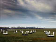
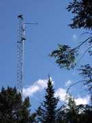
The Polarization Diversity Lidar (PDL) is a ground-based mobile lidar system developed at the University of Utah. It is a dual-wavelength (1.06 and 0.532 μm) scanning lidar that simultaneously measures backscatter and depolarization at both wavelengths to characterize clouds and aerosols. It has a spatial resolution of 1.5 meters and a temporal resolution of 0.1 seconds.

Instrument Details
- Lidar
- Earth Science > Spectral/engineering > Lidar > Lidar BackscatterEarth Science > Atmosphere > CloudsEarth Science > Spectral/engineering > LidarEarth Science > Atmosphere > AerosolsEarth Science > Spectral/engineering > Lidar > Lidar Depolarization RatioEarth Science > Atmosphere > Aerosols > Aerosol Backscatter
- Full Column Profile
- 0.1 s
- 1.5 m
- 282.8 THz, 563.5 THz
- Currently unavailable
Kenneth Sassen
Kenneth Sassen
University of Utah
Currently unavailable
 Field Site Stationary 76 Campaigns · 175 Instruments |  First International Satellite Cloud Climatology Project (ISCCP) Regional Experiment 1986—1998 Central and Midwest United States, California Coast, Northwest Africa, Alaska 5 Deployments · 131 Data Products
 Cirrus Regional Study of Tropical Anvils and Cirrus Layers Florida Area Cirrus Experiment 2002 Southern Florida 1 Deployment · 0 Data Products
| ||||||||||||||||
 Permanent Land Site Stationary 63 Campaigns · 100 Instruments |  SUbsonic aircraft: Contrail & Clouds Effects Special Study 1996 Central and Western United States 1 Deployment · 1 Data Product
|
Filter data products from this instrument by specific campaigns, platforms, or formats.