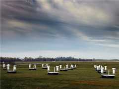
Rapid Acquisition SCanning Aerosol Lidar (RASCAL) is a mobile, ground-based lidar system developed by the Meteorological Service of Canada. It provides rapid-scanning lidar profiles of the lower troposphere at a 3-meter resolution along the beam axis. RASCAL measurements can be used to retrieve aerosol optical depth, planetary boundary layer height, and wind profiles under certain conditions. It operates at 1064 and 532 nm and can complete a full profile in about 30 to 60 seconds.

Instrument Details
- Lidar
- Earth Science > Atmosphere > Aerosols > Aerosol BackscatterEarth Science > Atmosphere > Atmospheric Pressure > Planetary Boundary Layer HeightEarth Science > Spectral/engineering > Lidar > Lidar BackscatterEarth Science > Spectral/engineering > LidarEarth Science > Atmosphere > Aerosols > Aerosol Optical Depth/thicknessEarth Science > Spectral/engineering > Lidar > Lidar Depolarization RatioEarth Science > Atmosphere > Altitude > Planetary Boundary Layer Height
- Full Column Profile
- 30-60 s
- 3 m
- 281.7 THz, 563.5 THz
- Currently unavailable
Kevin Strawbridge
Kevin Strawbridge
Meteorological Service of Canada
Currently unavailable
Currently unavailable
Unpublished
 Field Site Stationary 76 Campaigns · 175 Instruments | PAC2001 Pacific 2001 Air Quality Study 2001 Lower Fraser Valley, British Columbia, Canada 1 Deployment · 8 Data Products
|