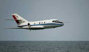
The Radar Airborne System Tool for Atmosphere (RASTA) is an airborne W-band pulsed Doppler cloud radar. It features a multibeam antenna system that enables three-dimensional wind profile retrievals above and below the aircraft. RASTA operates at 95.04 GHz with a beam width of 0.6 degrees. It has a range of up to 15 km and a resolution of 60 meters. RASTA is typically flown on the French ATR-42 aircraft.

Instrument Details
- Radar
- Earth Science > Spectral/engineering > Radar > Doppler VelocityEarth Science > Spectral/engineering > Radar > Radar ReflectivityEarth Science > Spectral/engineering > Radar > Radial Velocity > Mean Radial VelocityEarth Science > Spectral/engineering > Radar > Radar Imagery
- Full Column Profile
- Variable
- 60 m
- 95.04 GHz
- Currently unavailable
Julien Delanoë
Julien Delanoë
LATMOS
Currently unavailable
Currently unavailable
data center outside NASA
 Dassault Falcon 20-E5 6 Campaigns · 44 Instruments |  Hydrological Cycle in Mediterranean Experiment 2012 The Mediterranean 1 Deployment · 3 Data Products
|