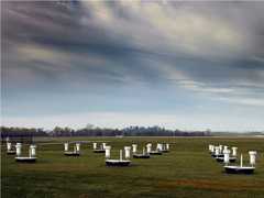
The Riegl VZ-1000 V-Line 3D Terrestrial Scanner is a type of surveying instrument that allows it to be operated in unique conditions due to its lightweight and compact size in situations such as forestry, mining, and archeological research. This instrument has a near-infrared laser capable of detecting a target over 1,400 meters away and can evaluate up to 122,000 measurements a second. Accuracy and precision of the Riegl VZ-1000 are 8 and 5 millimeters; respectively due to its small beam divergence of 0.3 milliradians.

Instrument Details
- Visible/Infrared
- Earth Science > Land Surface > Topography > Terrain ElevationEarth Science > Land Surface > Topography
- Land Surface
- < 1 sec
- Point
- Near-infrared
- http://www.riegl.com/uploads/tx_pxpriegldownloads/DataSheet_VZ-1000_2017-06-14.pdf
Currently unavailable
This data will be added in future versions
Riegl
Currently unavailable
Currently unavailable
Unpublished
 Campaign Field Sites Stationary 57 Campaigns · 160 Instruments |  SnowEx 2016—2023 Colorado, Idaho, Utah, Alaska Ongoing 4 Deployments · 26 Data Products
|
Filter data products from this instrument by specific campaigns, platforms, or formats.