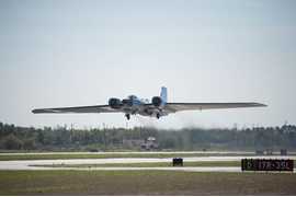
Roscoe is an airborne aerosol and cloud lidar system. It is a more compact version of the Cloud Physics Lidar (CPL) developed by Goddard Space Flight Center (GSFC). It was designed to observe both upward and downward from the aircraft, collecting profile measurements of attenuated backscatter and aerosol/cloud optical properties. Roscoe operates at 355 nm and 1064 nm and has a spatial resolution of 200 m. It has a temporal resolution of 1 second.

Instrument Details
- Lidar
- Earth Science > Spectral/engineering > Lidar > Lidar BackscatterEarth Science > Atmosphere > CloudsEarth Science > Spectral/engineering > LidarEarth Science > Atmosphere > AerosolsEarth Science > Atmosphere > Aerosols > Aerosol Optical Depth/thicknessEarth Science > Spectral/engineering > Lidar > Lidar Depolarization RatioEarth Science > Atmosphere > Clouds > Cloud Microphysics > Cloud Optical Depth/thicknessEarth Science > Atmosphere > Aerosols > Aerosol Backscatter
- Full Column Profile
- 1 s
- 200 m
- 844.5 THz, 281.7 THz
- Currently unavailable
Edward Nowottnick
Edward Nowottnick
GSFC
Currently unavailable
Currently unavailable
other NASA repository not formally considered a DAAC by ESDS
 NASA WB-57 17 Campaigns · 84 Instruments |  Stratospheric Aerosol processes, Budget, and Radiative Effects 2022—2027 Houston, Texas, Fairbanks, Alaska Ongoing 3 Deployments · 0 Data Products
 Asian Summer Monsoon Chemical & Climate Impact Project 2022 West Pacific, South Korea 1 Deployment · 8 Data Products
| ||||||||||||
 NASA Earth Resources-2 Aircraft 63 Campaigns · 109 Instruments |  GSFC Lidar Observation and Validation Experiment 2025 Southern California, Western United States, Pacific Ocean 1 Deployment · 0 Data Products
|
Filter data products from this instrument by specific campaigns, platforms, or formats.