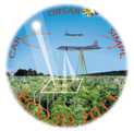
The Slope Imaging Multi-polarization Photon-counting Lidar (SIMPL) is an airborne, multi-beam, single-photon ranging lidar developed through the NASA Earth Science Technology Office (ESTO) Instrument Incubator Program (IIP). It measures lidar scattering properties to determine topography, surface roughness, vegetation characteristics, and surface elevation, typically for cryospheric research. SIMPL consists of four beams operating at green (532 nm) and near-infrared (1064 nm) wavelengths. It has a laser footprint of 0.3 m and a cross-track spacing of 8 m at a nominal flight altitude of 3.7 km.

Instrument Details
- Lidar
- Earth Science > Land Surface > TopographyEarth Science > Climate Indicators > Cryospheric Indicators > Glacial Measurements > Glacier Elevation/ice Sheet ElevationEarth Science > Land Surface > Topography > Terrain ElevationEarth Science > Spectral/engineering > Lidar > Lidar BackscatterEarth Science > Oceans > Sea Ice > Ice RoughnessEarth Science > Spectral/engineering > Lidar > Lidar Depolarization RatioEarth Science > Biosphere > Vegetation > Canopy CharacteristicsEarth Science > Biosphere > VegetationEarth Science > Oceans > Sea Ice > Sea Ice ElevationEarth Science > Cryosphere > Glaciers/ice Sheets > Glacier Thickness/ice Sheet ThicknessEarth Science > Cryosphere > Sea Ice > Ice RoughnessEarth Science > Land Surface > Topography > Surface Roughness
- Full Column Profile, Land Surface
- N/A
- 0.3 m
- 563.5 THz, 281.8 THz
- Currently unavailable
David Harding
David Harding
NASA
NASA
Currently unavailable
Unpublished
 P-3 Orion 30 Campaigns · 153 Instruments |  ECO-3D 2011 United States East Coast 1 Deployment · 0 Data Products
|