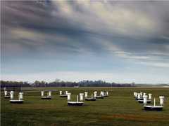
The Stratospheric InfraRed Interferometer Spectrometer (SIRIS) was a balloon-borne passive spectrometer developed at NASA's Goddard Space Flight Center (GSFC). It measured thermal emissions in the 5-15 μm spectral range to improve understanding of ozone behavior in the stratosphere. It had a vertical resolution of 3 km and a vertical coverage of up to 40 km. SIRIS had a field of view of 0.5 degrees and a scan time of 76 seconds. While primarily used on balloon platforms, it occasionally operated on ground-based platforms.

Instrument Details
- Spectrometer/Radiometer
- Earth Science > Spectral/engineering > Infrared Wavelengths > Thermal InfraredEarth Science > Spectral/engineering > Infrared Wavelengths > Infrared Radiance
- Lower Stratosphere
- 76 s
- 3 km
- 20-60 THz
- https://doi.org/10.1364/AO.27.004964
Currently unavailable
Currently unavailable
GSFC
Currently unavailable
Unpublished
 Field Site Stationary 76 Campaigns · 175 Instruments | OTTER Oregon Transect Ecosystem Research Project 1989—1991 western coniferous forest in Oregon 3 Deployments · 14 Data Products
 First International Satellite Cloud Climatology Project (ISCCP) Regional Experiment 1986—1998 Central and Midwest United States, California Coast, Northwest Africa, Alaska 5 Deployments · 131 Data Products
ACCP Accelerated Canopy Chemistry Program 1992—1993 Harvard Forest, MA; Blackhawk Island, WI; Howland, ME; Gainesville, FL; Jasper Ridge, CA; Dunnigan, CA; Pleasant Grove, CA 1 Deployment · 6 Data Products
|
Filter data products from this instrument by specific campaigns, platforms, or formats.