The Scanning L-Band Active/Passive (SLAP) is an airborne remote sensor developed at Goddard Space Flight Center (GSFC). SLAP is an airborne simulator for NASA’s Soil Moisture Active/Passive (SMAP) satellite and is used to retrieve soil moisture and soil freeze/thaw state measurements. It consists of three instruments: a passive microwave radiometer, an active scatterometer, and a thermal infrared sensor for surface temperature measurements. The radiometer operates at 1.4 GHz, while the scatterometer operates in the 1.2-1.3 GHz range. SLAP has a 100x200-meter footprint at a flight altitude of 300 meters.

Instrument Details
- Multi
- Earth Science > Land Surface > Soils > Soil Moisture/water ContentEarth Science > Agriculture > Soils > Soil Moisture/water ContentEarth Science > Land Surface > Soils > Soil Salinity/soil SodicityEarth Science > Spectral/engineering > Microwave > Brightness TemperatureEarth Science > Spectral/engineering > Radar > Radar BackscatterEarth Science > Agriculture > Soils > Soil Salinity/soil Sodicity
- Land Surface
- N/A
- 100x200m
- 1.4 GHz, 1.2-1.3 GHz
- https://doi.org/10.1109/IGARSS.2016.7729068
Edward Kim
Edward Kim
GSFC
Currently unavailable
Currently unavailable
Currently unavailable
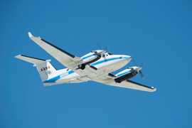
 Beechcraft B-200 King Air 39 Campaigns · 84 Instruments |  FireSense 2023—2027 Western United States, Southeastern United States, California, Montana, Arizona, Utah, Colorado, Alabama, Florida, Georgia, Mississippi, Texas, Oklahoma Ongoing 3 Deployments · 1 Data Product
 Student Airborne Research Program 2009—2026 Southern California, Virginia Ongoing 19 Deployments · 25 Data Products
 Integrated Precipitation and Hydrology Experiment 2014 Southern Appalachians, including portions of North Carolina, South Carolina, Tennessee, Georgia 1 Deployment · 47 Data Products
|
Filter data products from this instrument by specific campaigns, platforms, or formats.