The Turbulent Air Motion Measurement System (TAMMS) is an in situ airborne sensor that collects aircraft navigation data. TAMMS comprises several subsystems, including pressure transducers and temperature sensors, an aircraft inertial navigation system, a central data acquisition system, and water vapor and other gas sensors. It provides measurements of aircraft position, flight-level winds, temperature, pressure, and water vapor. TAMMS has a typical sampling frequency of less than 1 second and a spatial resolution of 5 meters.

Instrument Details
- Position/Navigation
- Earth Science > Atmosphere > Atmospheric Winds > Upper Level WindsEarth Science > Atmosphere > Atmospheric Water VaporEarth Science > Atmosphere > Atmospheric PressureEarth Science > Atmosphere > Atmospheric Water Vapor > Water Vapor Indicators > Water VaporEarth Science > Atmosphere > Atmospheric Winds > Upper Level Winds > Wind DirectionEarth Science > Atmosphere > Atmospheric Winds > Upper Level Winds > Wind SpeedEarth Science > Atmosphere > Atmospheric Pressure > Atmospheric Pressure MeasurementsEarth Science > Atmosphere > Atmospheric Temperature > Upper Air TemperatureEarth Science > Atmosphere > Atmospheric Winds > Upper Level Winds > Flight Level WindsEarth Science > Atmosphere > Atmospheric TemperatureEarth Science > Atmosphere > Atmospheric Winds
- Troposphere
- < 1 second
- 5 m
- N/A
- https://ntrs.nasa.gov/api/citations/19970010469/downloads/19970010469.pdf
Lee Thornhill
Lee Thornhill
Currently unavailable
Currently unavailable
Currently unavailable
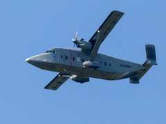 Short Brothers C-23 Sherpa 4 Campaigns · 22 Instruments | CARAFE NASA Carbon Atmospheric Flux Experiment 2016—2017 Eastern United States Coast, Mid-Atlantic Region 2 Deployments · 1 Data Product
| ||||||||||||||||||||||||||||||||||||||||||||||||
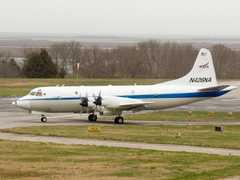 P-3 Orion 30 Campaigns · 153 Instruments |  Observations of Aerosols above Clouds and their Interactions 2016—2018 Southeastern Atlantic Ocean, Southern Africa 3 Deployments · 8 Data Products
 Investigation of Microphysics and Precipitation for Atlantic Coast-Threatening Snowstorms 2020—2023 Eastern United States 3 Deployments · 73 Data Products
PEM Pacific Exploratory Mission 1991—1999 Pacific Ocean 4 Deployments · 51 Data Products
TRACE Transport and Atmospheric Chemistry near the Equator 1992—2001 Brazil, Southern Africa, Tropical Atlantic, Central & Western Regions of the Pacific Ocean Basin 2 Deployments · 25 Data Products
SMEX Soil Moisture Experiment 2002—2005 Iowa, Oklahoma, Georgia, Alabama, Arizona, Sonora, Mexico 4 Deployments · 0 Data Products
AMSRIce Advanced Microwave Scanning Radiometer Sea Ice Product Validation 2003—2006 Alaska, Elson Lagoon, Beaufort Sea, Chukchi Sea, Bering Sea, Northern Pacific Ocean 2 Deployments · 0 Data Products
| ||||||||||||||||||||||||||||||||||||||||||||||||
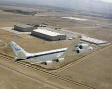 Douglas DC-8 45 Campaigns · 182 Instruments | TRACE Transport and Atmospheric Chemistry near the Equator 1992—2001 Brazil, Southern Africa, Tropical Atlantic, Central & Western Regions of the Pacific Ocean Basin 2 Deployments · 25 Data Products
| ||||||||||||||||||||||||||||||||||||||||||||||||
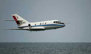 Dassault Falcon 20-E5 6 Campaigns · 44 Instruments |  Aerosol Cloud meTerology Interactions oVer the western ATlantic Experiment 2020—2022 Western North Atlantic Ocean 6 Deployments · 12 Data Products
| ||||||||||||||||||||||||||||||||||||||||||||||||
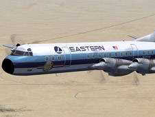 Lockheed L-188C Electra 6 Campaigns · 36 Instruments | ABLE Global Tropospheric Experiment - Atmospheric Boundary Layer Experiment 1984—1990 Tropical North Atlantic Ocean, Amazon Rainforest, Greenland, Eastern Canada, Alaska 5 Deployments · 25 Data Products
| ||||||||||||||||||||||||||||||||||||||||||||||||
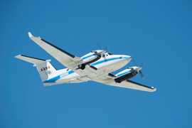 Beechcraft B-200 King Air 39 Campaigns · 84 Instruments |  Student Airborne Research Program 2009—2026 Southern California, Virginia Ongoing 19 Deployments · 25 Data Products
|
Filter data products from this instrument by specific campaigns, platforms, or formats.